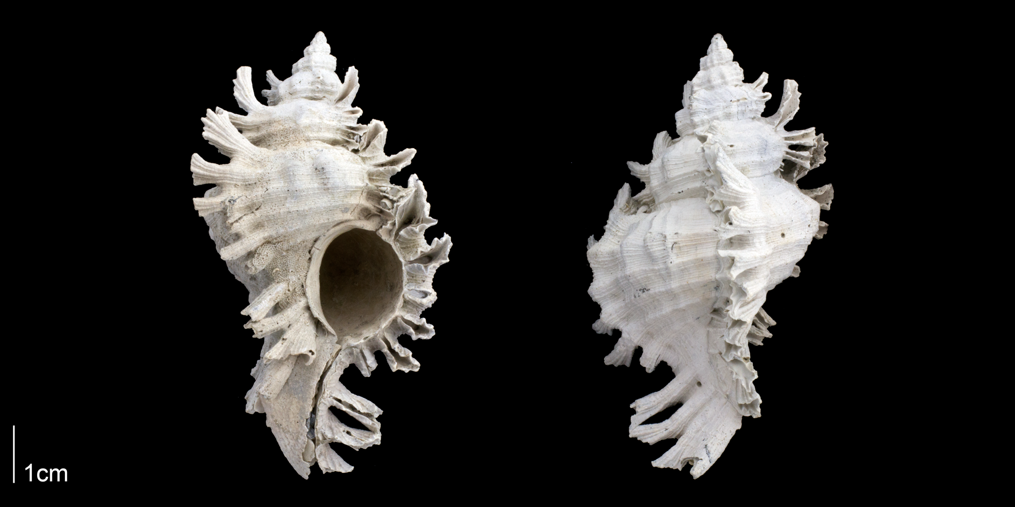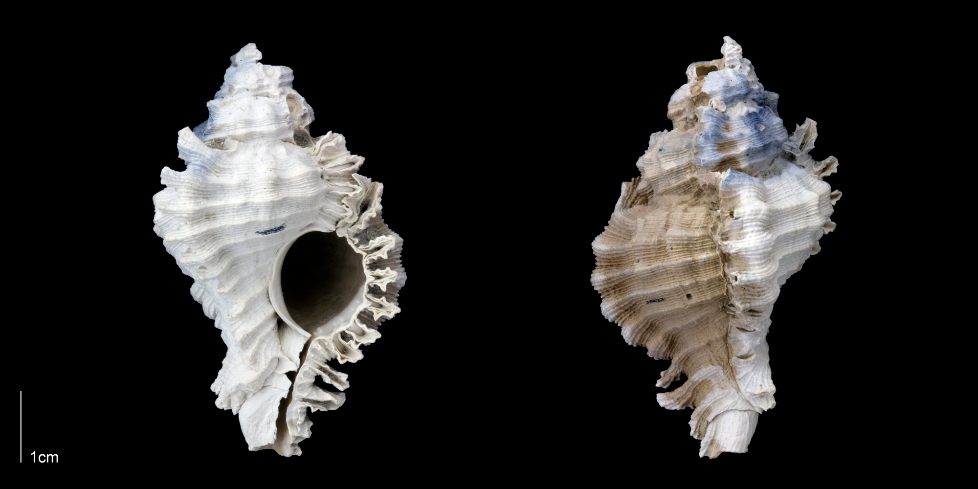
Chicoreus floridanus
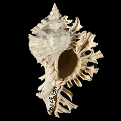
- Phylum: Mollusca
- Class: Gastropoda
- Order: Neogastropoda
- Family: Muricidae
- Genus: Chicoreus
- Species: Chicoreus floridanus (Vokes, E., 1965)
Geological Range
Late Pliocene to Late Pleistocene; Extinct.
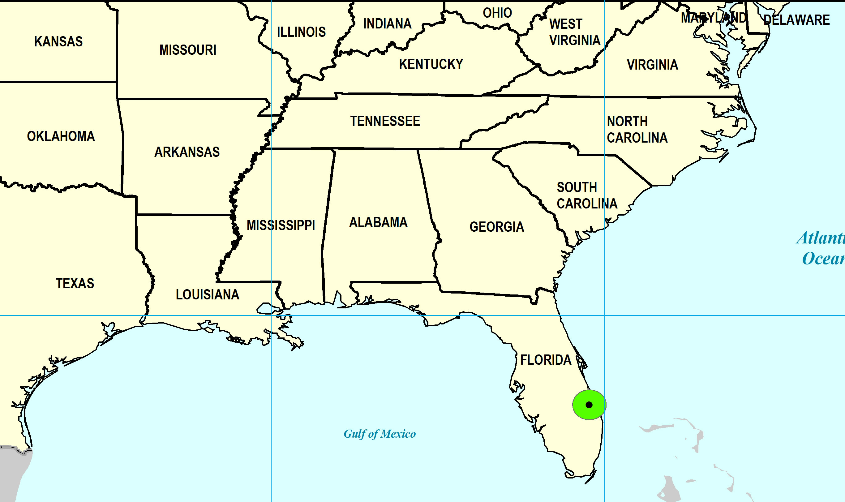
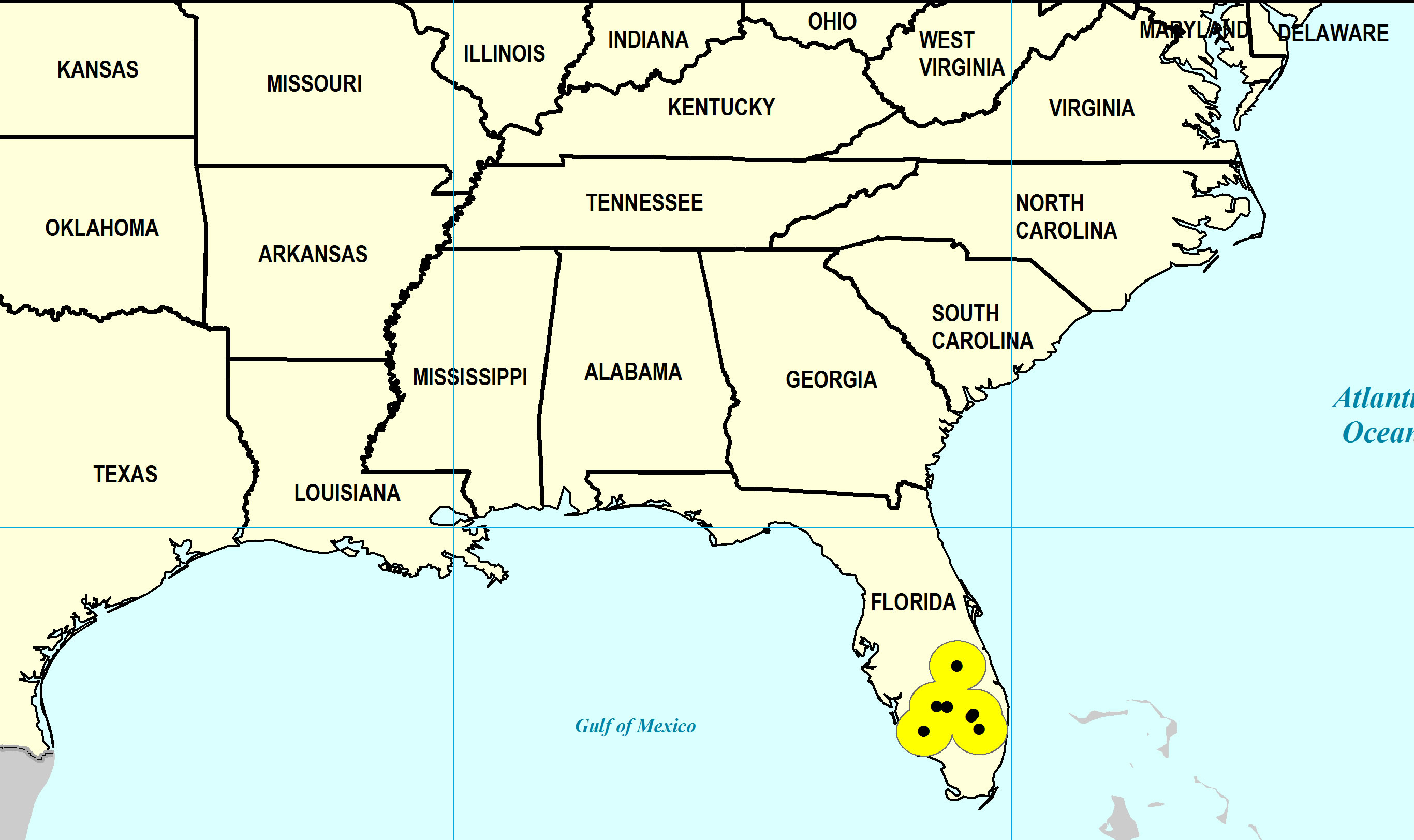
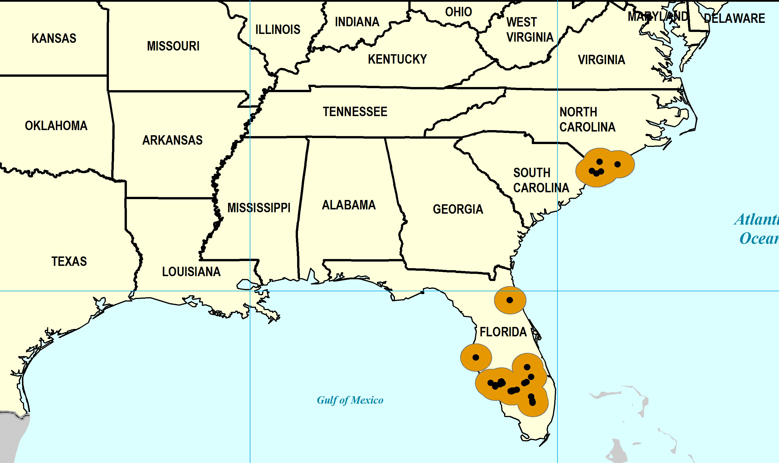
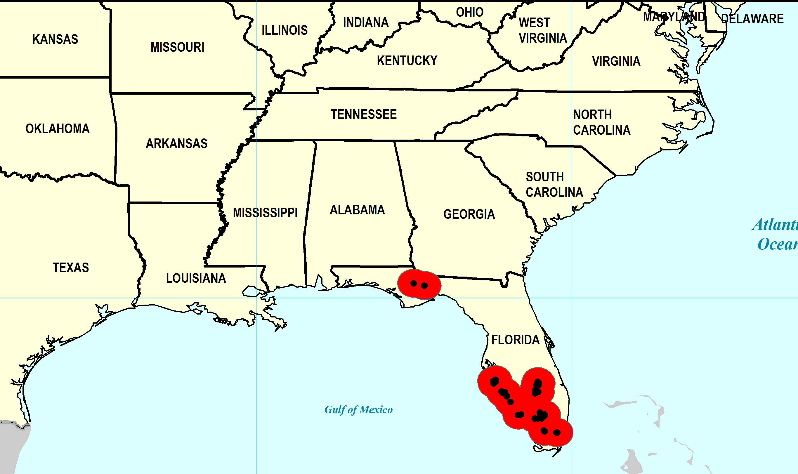
Paleogeographic Distribution
Southern Florida to North Carolina.
Stratigraphic Occurrences
- Late Pleistocene
- Pamlico Formation (S. FL)
- Middle Pleistocene
- Bermont Formation (S. FL)
- Early Pleistocene
- Caloosahatchee Formation (S. FL)
- Nashua Formation (N. FL)
- Waccamaw Formation (SC, NC)
- Late Pliocene
- Jackson Bluff Formation (N. FL)
- Tamiami Formation (Murdock Station Member) (S. FL)
- Tamiami Formation (Pinecrest Beds) (S. FL)