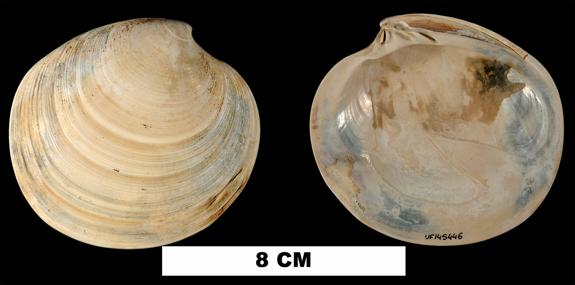
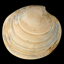
Dosinia discus
- Phylum: Mollusca
- Class: Bivalvia
- Order: Imparidentia
- Family: Veneridae
- Genus: Dosinia
- Species: Dosinia discus (Reeve, 1851)
- Common Name: Disk dosinia
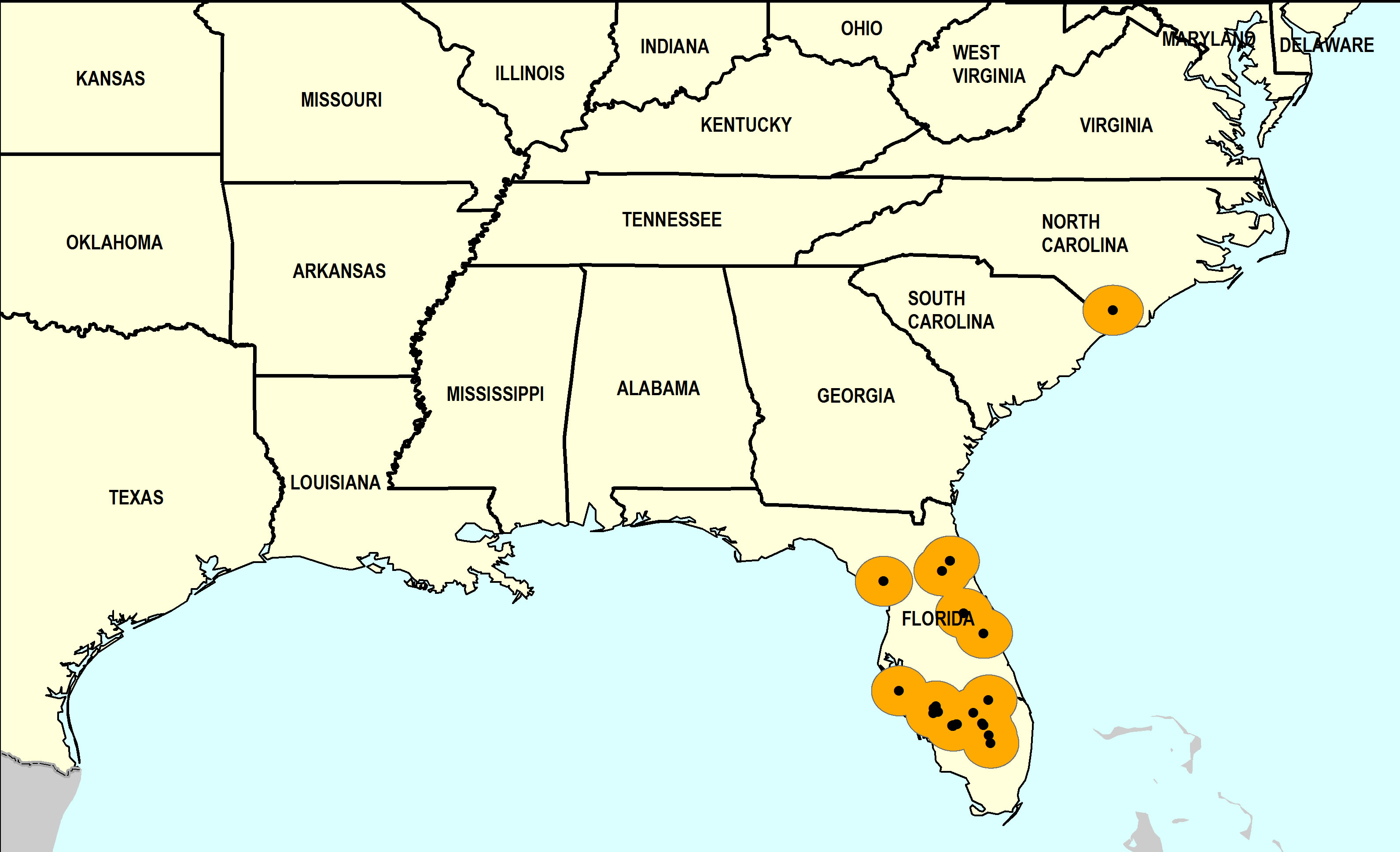
Geological Range
Late Pliocene to Late Pleistocene; Recent.
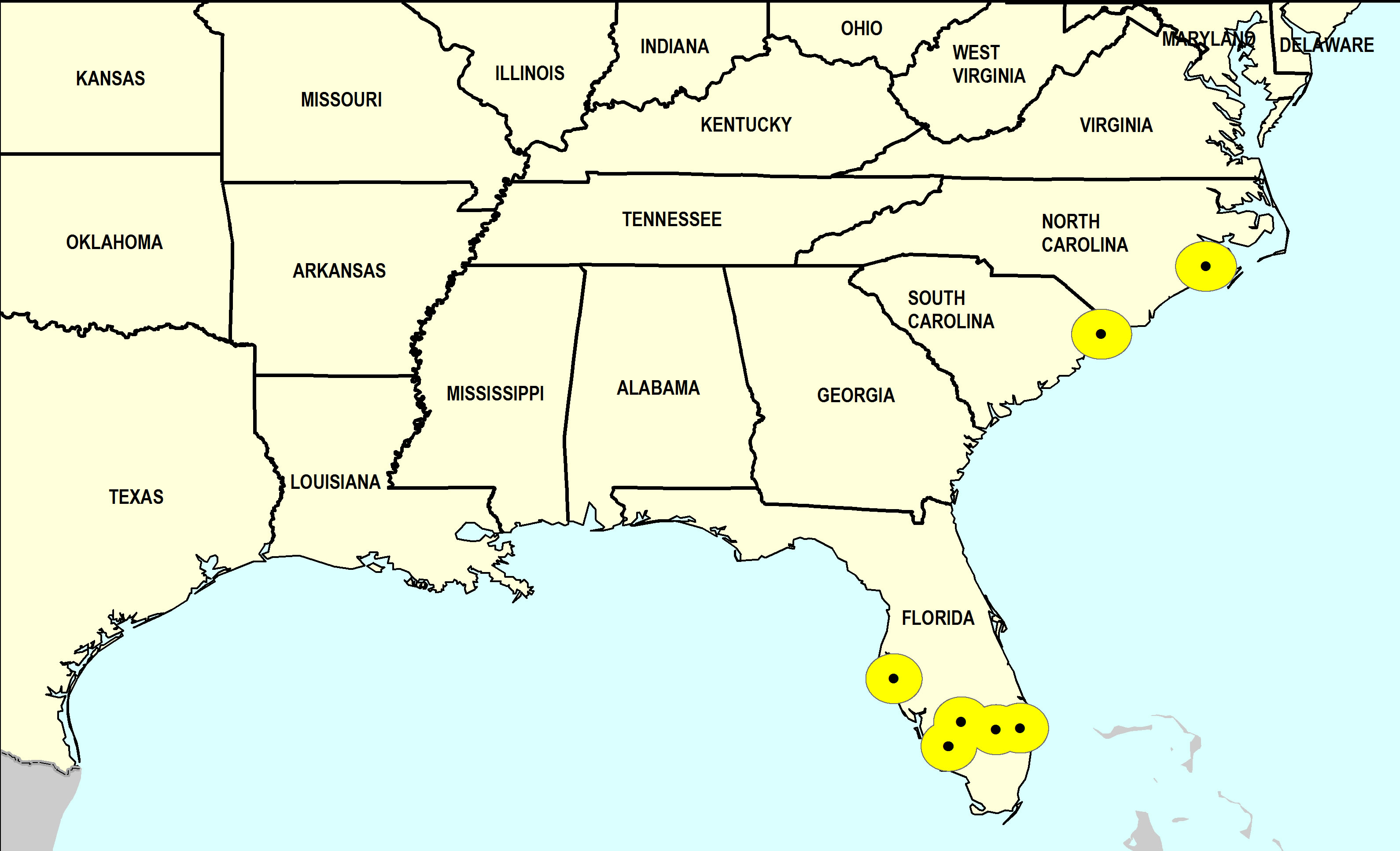
Paleogeographic Distribution
Southern Florida to North Carolina.
Remarks
For information on the modern distribution of the species, see Malacolog.
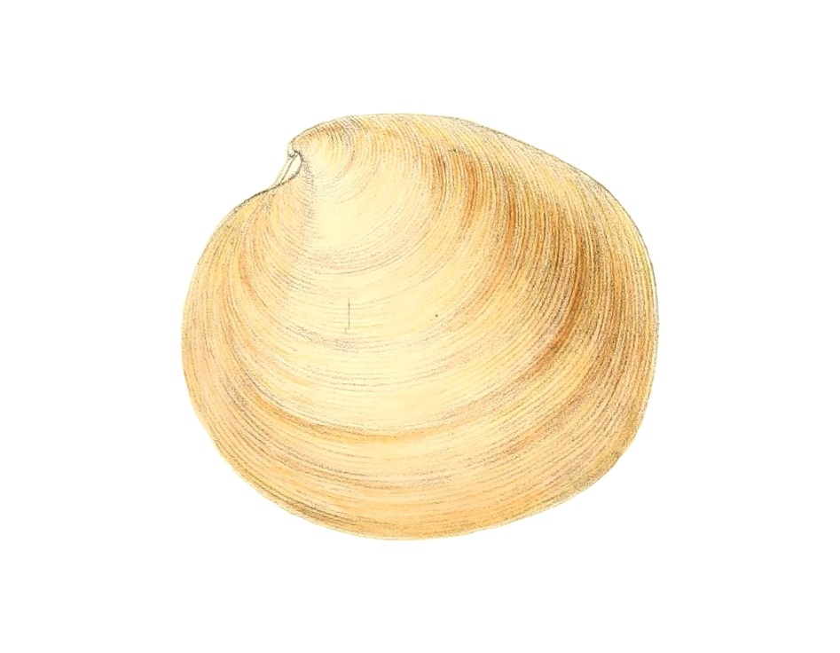
Original Description (from Reeve, 1851, p. 84):
"THE QUOIT ARTEMIS. Shell rather thin, transversely ovate, posteriorly somewhat square, broader than high, very compressed, concentrically very finely engraved with striae, intermediate ridges rather obsolete and decreasing in number at the sides, area of the ligament simple, lunule rotundately heart-shaped; whitish, sometimes, but obscurely, stained with light rust bands, and covered with a thin horny epidermis.
Hab. United States.
This fine species is chiefly distinguished by its compressed growth and fine sculpture."
To access this description in its original formatting through the Biodiversity Heritage Library, click here.
Stratigraphic Occurrences
- Late Pleistocene
- Anastasia Formation (S. FL)
- Coffee Mill Hammock Formation (S. FL)
- Flanner Beach Formation (NC)
- Fort Thompson Formation (S. FL)
- Middle Pleistocene
- Bermont Formation (S. FL)
- Canepatch Formation (SC)
- Early Pleistocene
- Caloosahatchee Formation (S. FL)
- Nashua Formation (N. FL)
- Waccamaw Formation (NC)
- Late Pliocene
- Tamiami Formation (Pinecrest Beds) (S. FL)