
Neogene Geology of the Southeastern United States
Overview
The Neogene Period is comprised of two epochs (subdivisions): the Miocene (23 million to 5.3 million years ago) and the Pliocene (5.3 million to 2.6 million years ago). We also include on this website fossils from the Pleistocene epoch (2.6 million to 10,000 years ago) because they have a great deal of similarity with fossils from the Pliocene epoch. While 23 million years seems like a long time ago, the Neogene and Pleistocene are geologically very young. The earth is 4.6 billion years old, so these time intervals represent just the last 0.56% of earth’s history.
The Neogene and Pleistocene fossil record of the southeastern United States—defined here as the United States Coastal Plain from Virginia to the panhandle of Florida—is extensive and has been collected and studied by paleontologists for nearly 200 years.
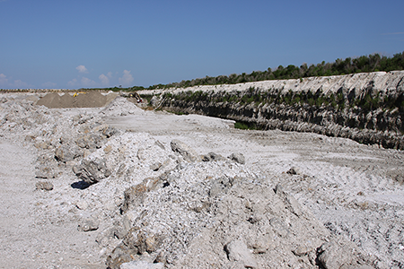
A quarry operation in southern Florida.
Some fossil localities in the southeastern United States, particularly in southern Florida, have a staggering abundance of fossils and in some cases the numerous fossils themselves are mined to provide aggregate for road construction.
Many of the Neogene fossils from the southeastern United States are found in “unconsolidated” sediments (e.g., sand). This means that the sediments have not yet been lithified, or turned into stone. Because of this, these fossils require little preparation work (usually just a bit of washing) before they are ready to be studied by scientists.
While a wide range of fossil types have been found in the Neogene fossil record of the southeastern United States, this atlas will focus on those invertebrate (animals lacking a backbone) species that are most commonly encountered.
Fossil Deposits
Despite being geologically young, many of the fossil-bearing sedimentary layers (called strata) considered here are challenging to match up (or correlate) with each other across the Coastal Plain. There are several reasons why.
One is that many of them are “negative exposures”: anyone who has driven across Florida and other areas near the ocean along the Coastal Plain can appreciate the fact that the landscape is very flat and there are next to no outcroppings of strata along the road. To find fossils in these places, digging into the Earth is required. Thus, most of our knowledge of the Neogene fossil record in this region comes from quarrying operations. Because such quarries are not distributed evenly over space, there is some uncertainty about what strata (and fossils) are preserved beneath the surface in between.
A second reason why these strata are challenging to correlate from place-to-place is that they lack igneous layers such as volcanic ash that could be directly dated using radiometric approaches (during their formation, there were no volcanoes anywhere nearby).
Because of these issues, geologists have to rely upon using the fossil record to match-up deposits of the same age from place to place. In particular, they use fossils that only existed for short amounts of time (thus defining narrow windows of time) to match fossil deposits from place to place. These kinds of fossils are called “guide fossils” or “index fossils”.
Geological Units
- Late Pleistocene [View Map]
- Anastasia Formation
- Coffee Mill Hammock Formation
- Falmouth Formation
- Flanner Beach Formation
- Fort Thompson Formation
- Ironshore Formation
- Jaimanitas Formation
- Neuse Formation
- Pamlico Formation
- Satilla Formation
- Socastee Formation
- Middle Pleistocene [View Map]
- Bermont Formation
- Canepatch Formation
- Early Pleistocene [View Map]
- Abisinia Formation
- Bear Bluff Formation
- Caloosahatchee Formation
- Chowan River Formation
- James City Formation
- Nashua Formation
- Urraca Formation
- Waccamaw Formation
- Late Pliocene [View Map]
- Croatan Formation
- Duplin Formation
- Guaiguaza Clay
- Intracoastal Formation
- Jackson Bluff Formation
- Mare Formation
- Raysor Formation
- Tamiami Formation
- Yorktown Formation
- Early Pliocene [View Map]
- Agueguexquite Formation
- Bowden Formation
- Goose Creek Limestone
- Peace River Formation
- Playa Grande Formation
- Torreya Formation
- Late Miocene [View Map]
- Gatun Formation
- Middle Miocene [View Map]
- Coosawhatchie Formation
- Gatun Formation
- Playa Grande Formation
- Shoal River Formation
- Torreya Formation
- Early Miocene [View Map]
- Arcadia Formation
- Calvert Formation
- Chattahoochee Formation
- Chipola Formation
- Oak Grove Sand
- Penney Farms Formation
![[View Map]](/images/maps/LatePleistoceneFormation.jpg)
![[View Map]](/images/maps/MiddlePleistoceneFormation.jpg)
![[View Map]](/images/maps/EarlyPleistoceneForamtion.jpg)
![[View Map]](/images/maps/LatePlioceneFormation.jpg)
![[View Map]](/images/maps/EarlyPlioceneFormation.jpg)
![[View Map]](/images/maps/LateMioceneFormation.jpg)
![[View Map]](/images/maps/MiddleMioceneFormation.jpg)
![[View Map]](/images/maps/EarlyMioceneFormation.jpg)
Paleoenvironments
Most of the fossils known from the Neogene and Pleistocene records of the southeastern United States were originally deposited in a marine environment (that is, saltwater). We know this because of the kinds of fossils preserved. For example, we find fossils of corals and close relatives of species of snails and clams that only live in marine habitats today; we must assume that this was the case in the past as well (a geologic principle called uniformitarianism).
During much of the Neogene, sea-level was much higher than it is today because there was far less ice on earth. Thus, low-lying areas along the modern-day coast were flooded and supported thriving communities of ancient animals. As the northern hemisphere of the earth began to cool during the Pleistocene, glaciers began to form at high latitudes and drew water from the oceans, causing sea-level to fall.
Scientists think that the Pliocene earth may be a very good representation (or proxy) of what earth will be like over the next several centuries due to global climate change. Thus, understanding the Neogene fossil record of the southeastern United States can allow us to make predictions about how life will be impacted in the future by changing climate.