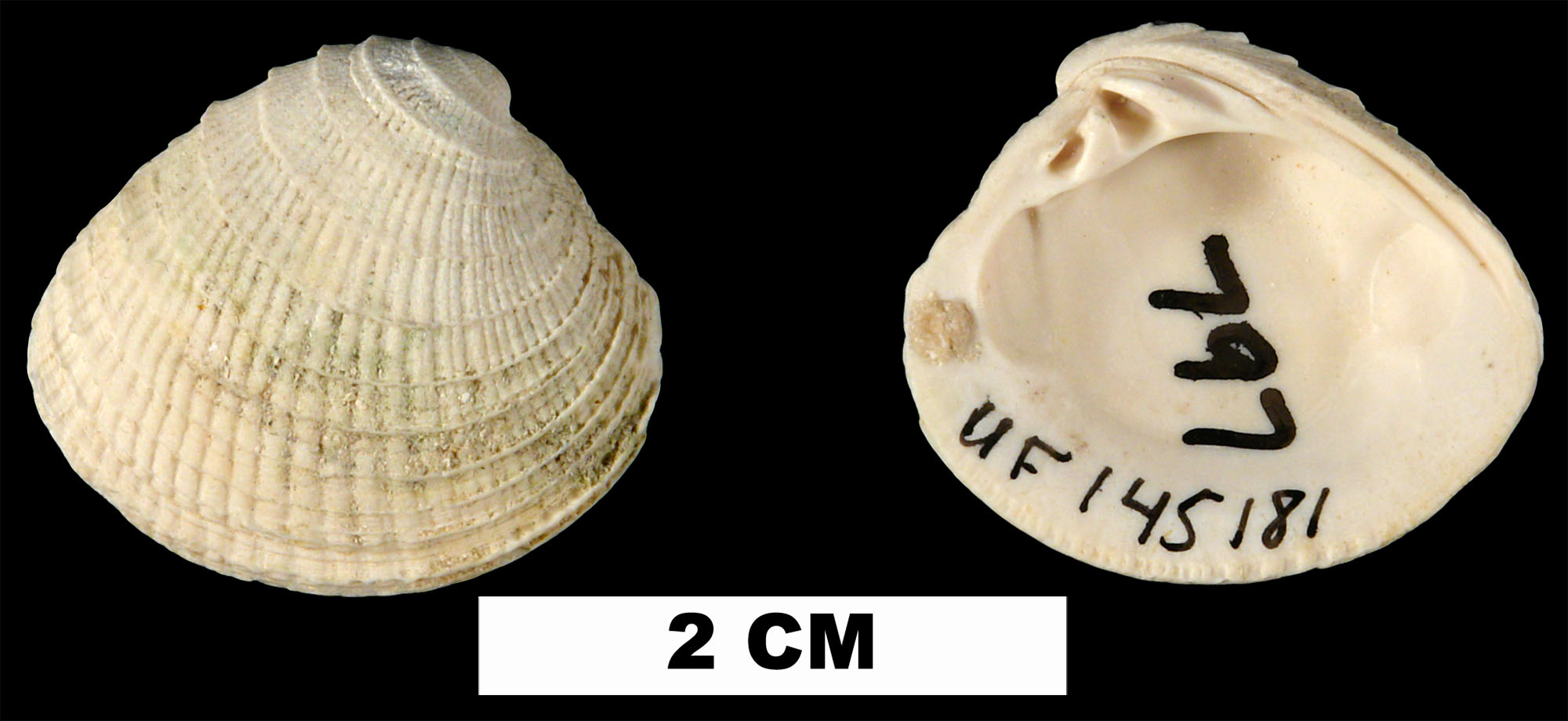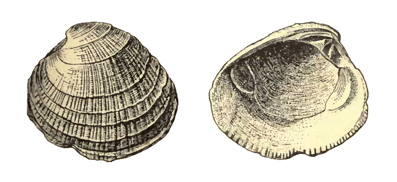
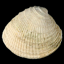
Chione erosa
- Phylum: Mollusca
- Class: Bivalvia
- Order: Imparidentia
- Family: Veneridae
- Genus: Chione
- Species: Chione erosa (Dall, 1903)
Geological Range
Late Pliocene to Late Pleistocene; Extinct.
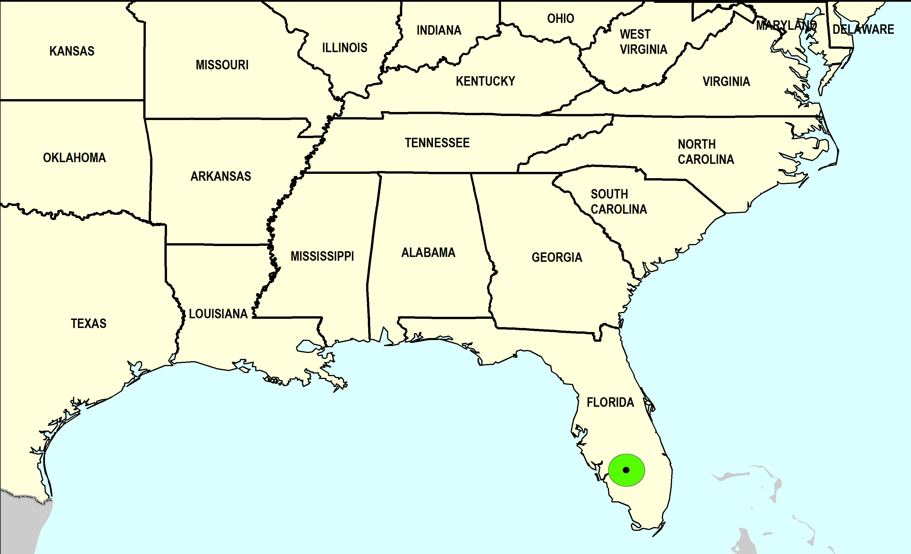
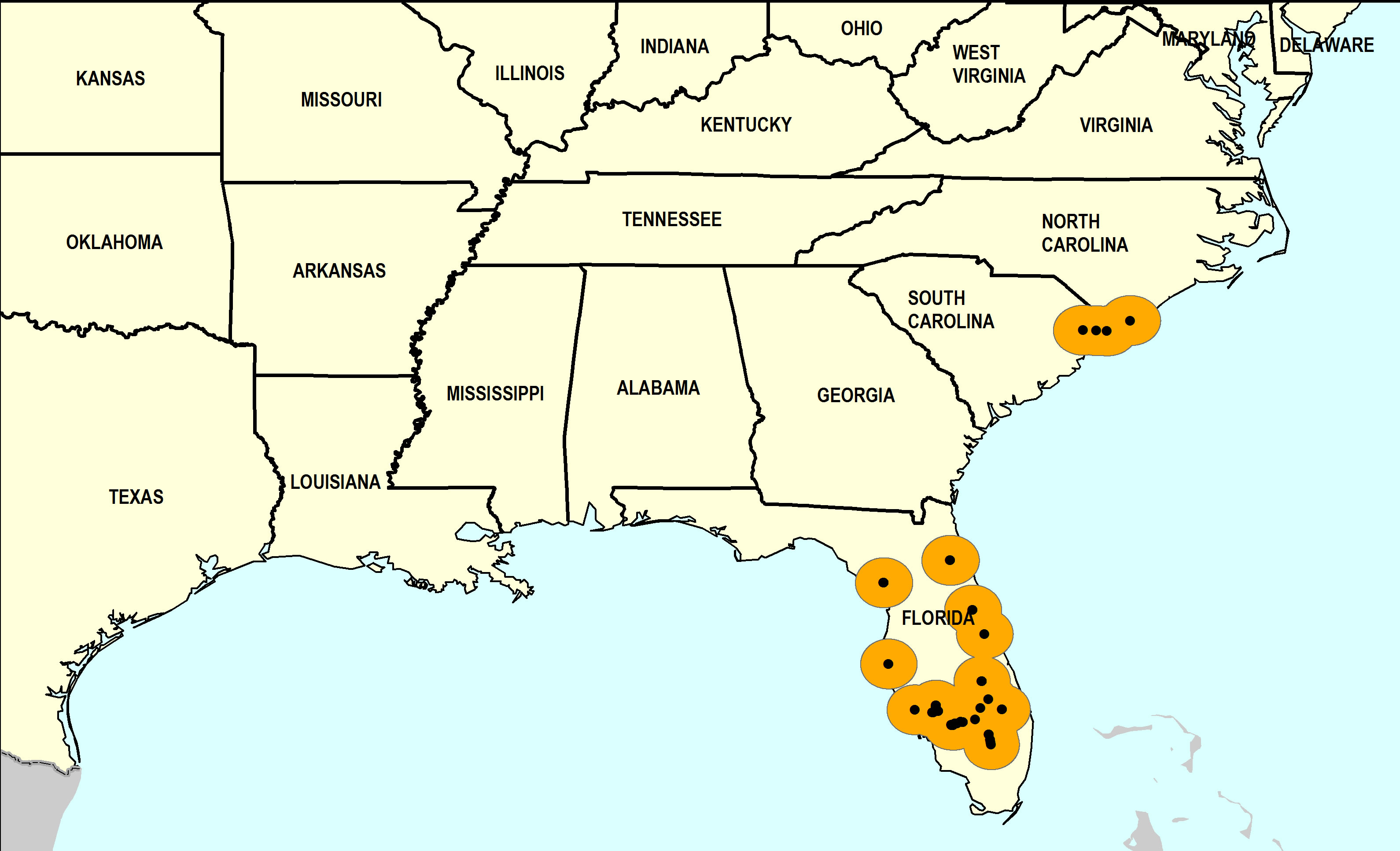
Paleogeographic Distribution
Southern Florida to North Carolina.
Remarks
Original Description (from Dall, 1903, p. 1290):
"Miocene of Florida, sixteen miles southwest of Tallahassee near and at Jackson Bluff (upper bed); Vaughan.
Shell rather large, compressed, the sculpture behind the middle of the disk obsolete, the radial feebly defined, the concentric lamellae little elevated and distant; hinge normal, the teeth entire; anterior adductor scar elongated, posterior shorter and smaller; pallial sinus nearly obsolete; lunule slightly larger and proportionately narrower than in C. cancellata. Length 35, height 32, diameter 17 mm.
Many of the specimens have the sculpture almost entirely obsolete."
To access this description in its original formatting through Google Books, click here.
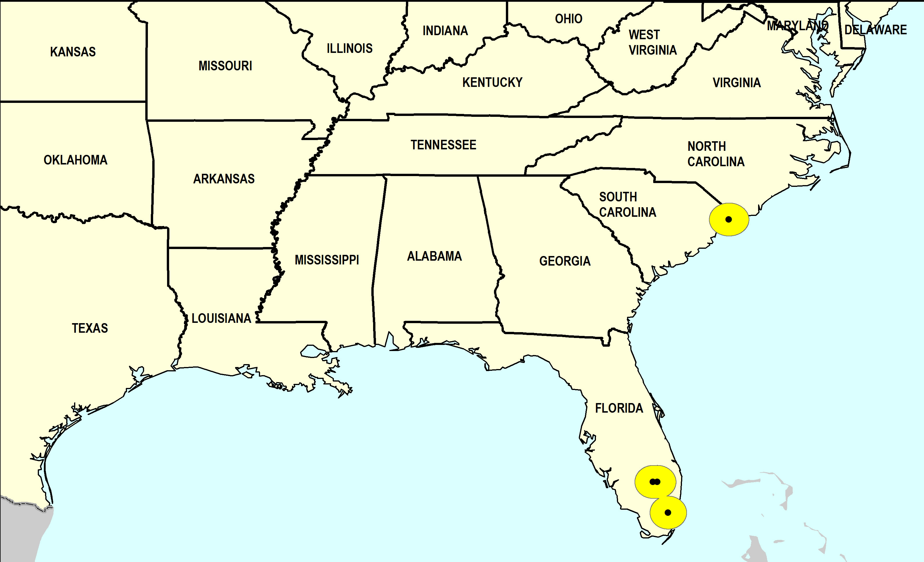
Stratigraphic Occurrences
- Late Pleistocene
- Coffee Mill Hammock Formation (S. FL)
- Middle Pleistocene
- Bermont Formation (S. FL)
- Canepatch Formation (SC)
- Early Pleistocene
- Bear Bluff Formation (SC)
- Caloosahatchee Formation (S. FL)
- Nashua Formation (N. FL)
- Waccamaw Formation (SC, NC)
- Late Pliocene
- Duplin Formation (SC)
- Jackson Bluff Formation (N. FL)
- Raysor Formation (SC)
- Tamiami Formation (Pinecrest Beds) (S. FL)