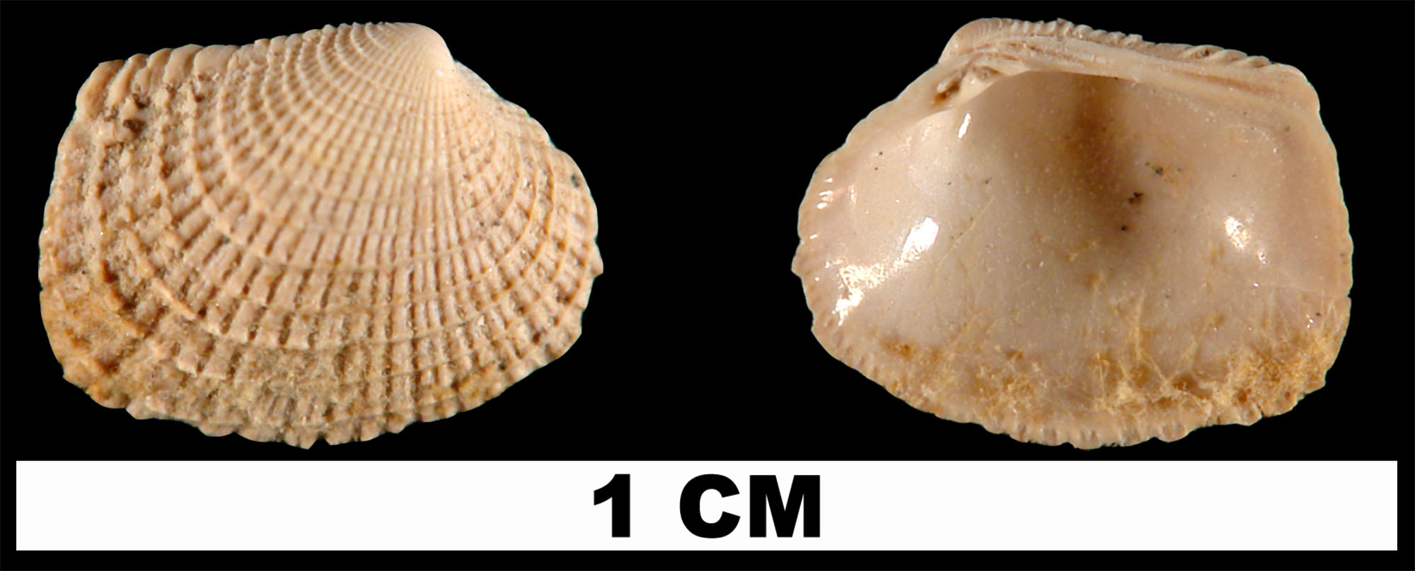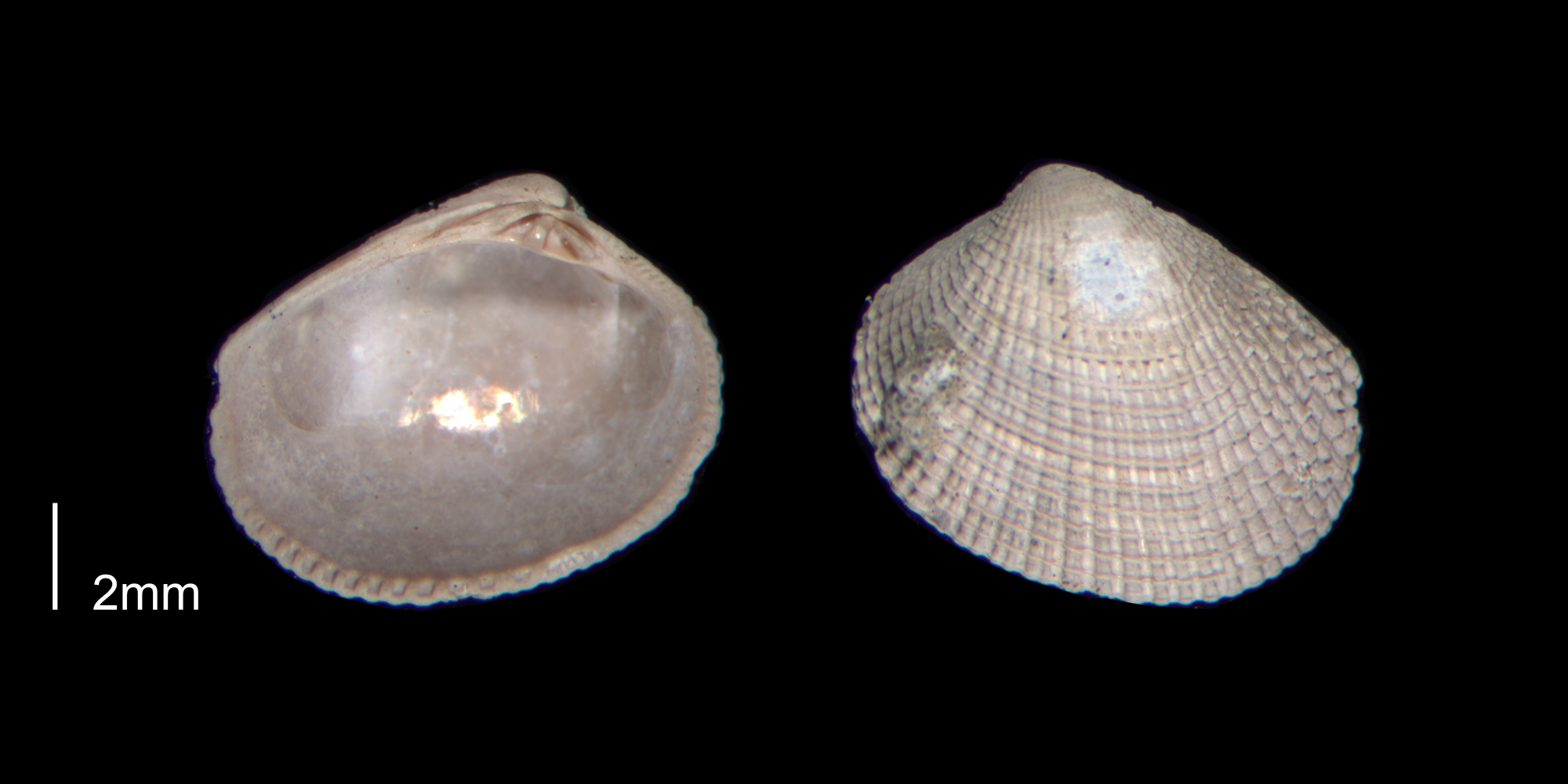
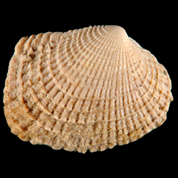
Chioneryx grus
- Phylum: Mollusca
- Class: Bivalvia
- Order: Imparidentia
- Family: Veneridae
- Genus: Chioneryx
- Species: Chioneryx grus (Holmes, 1858)
- Common Name: Grey pygmy venus
Geological Range
Late Pliocene to Late Pleistocene; Recent.
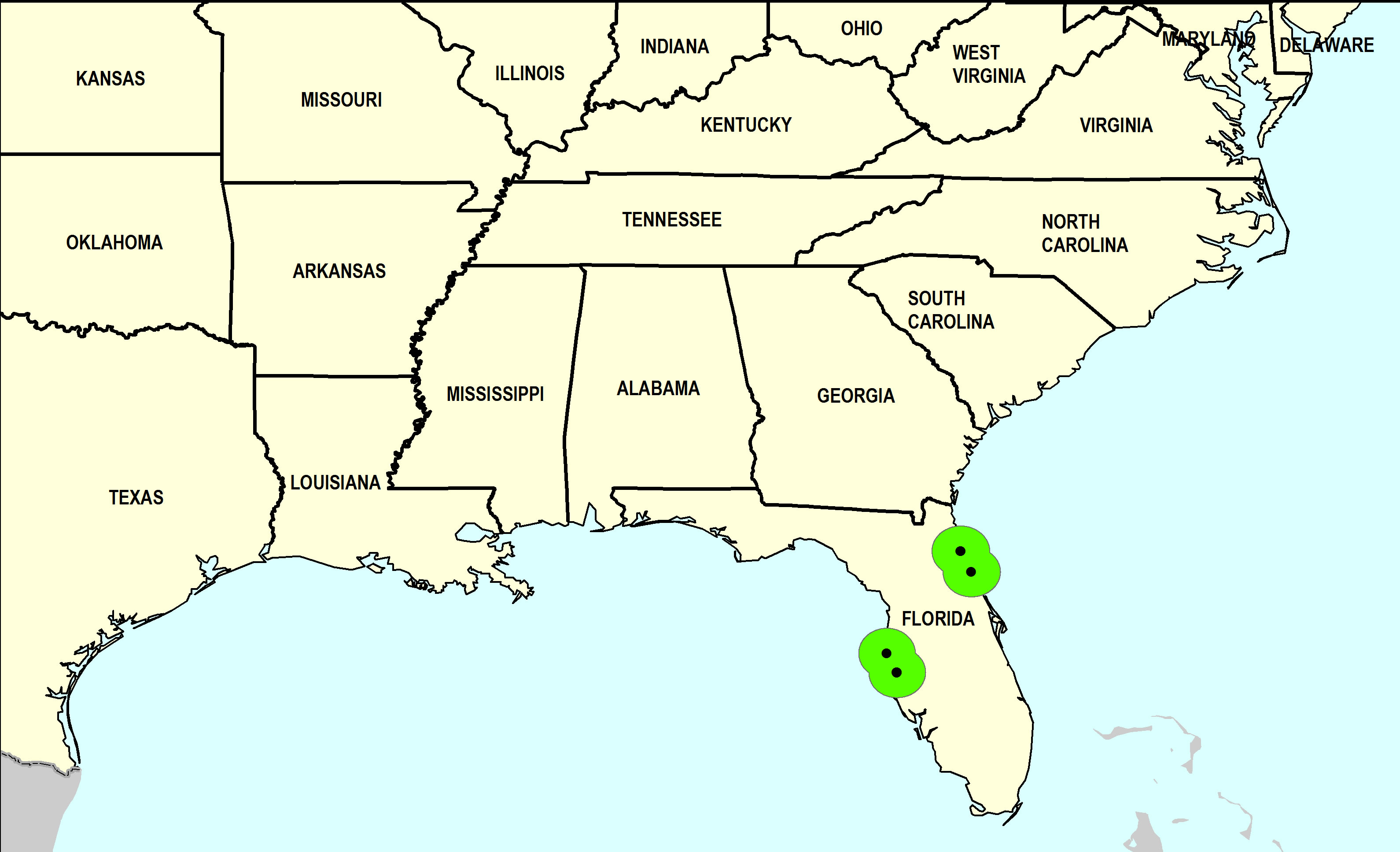
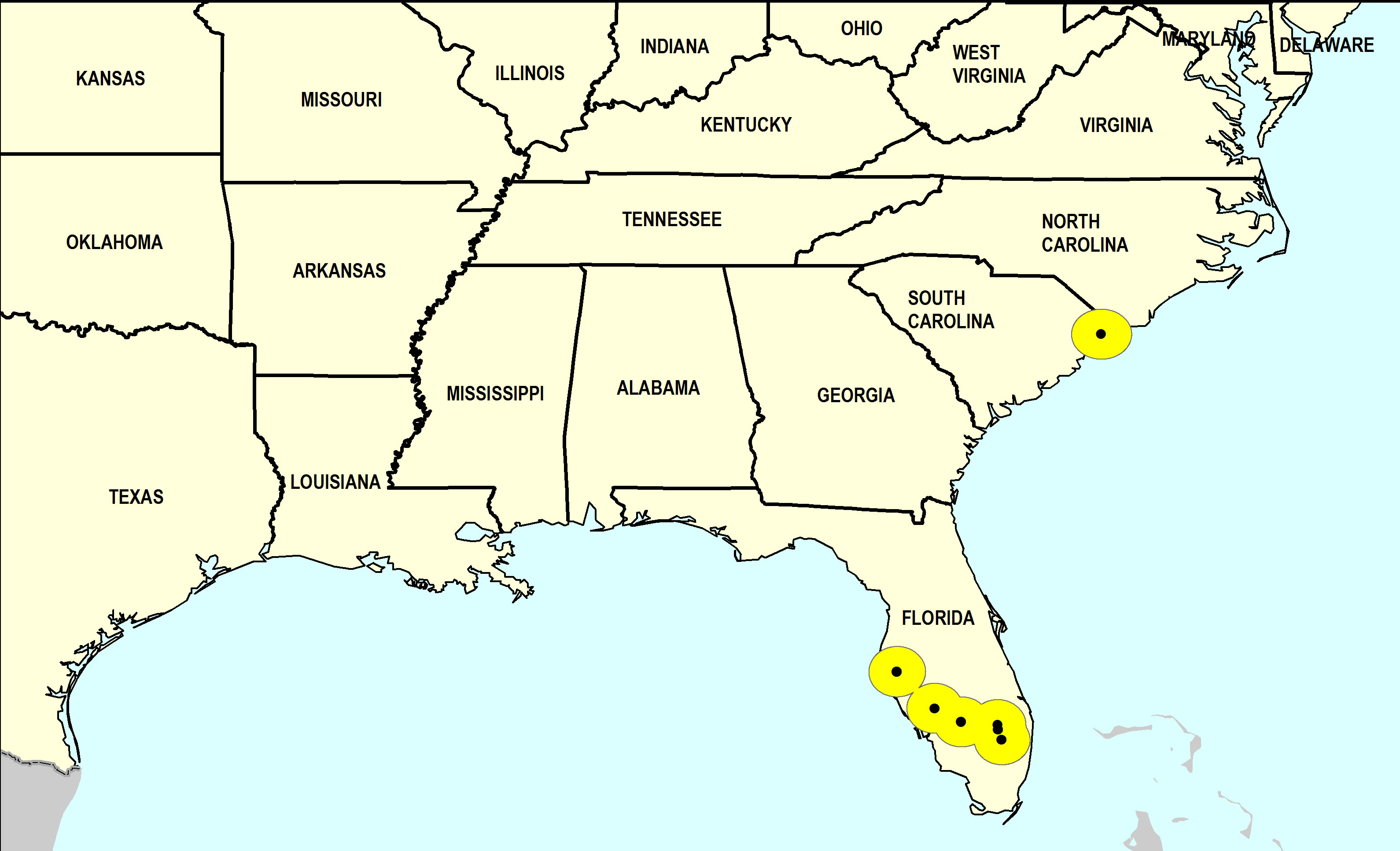
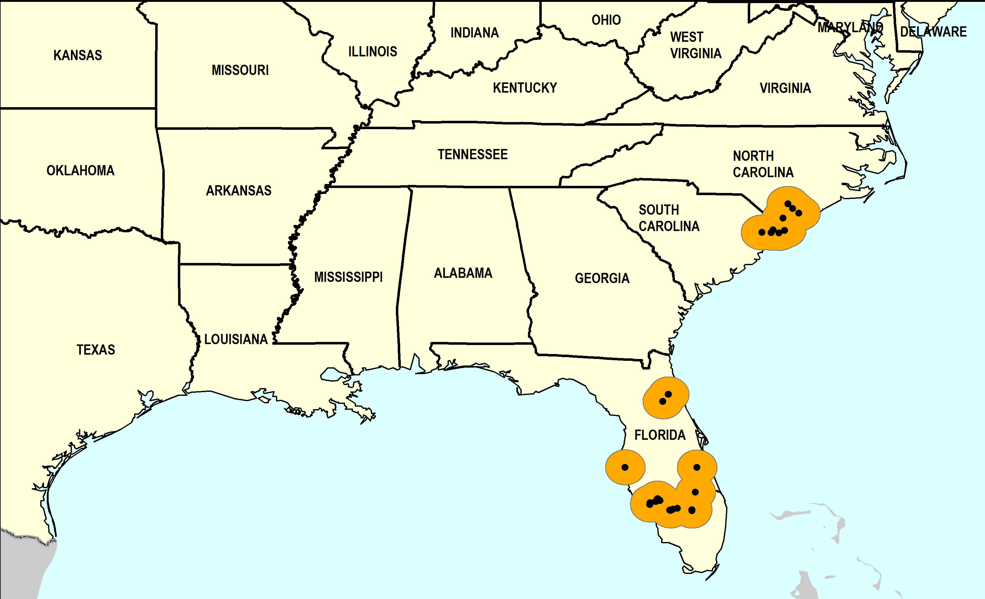
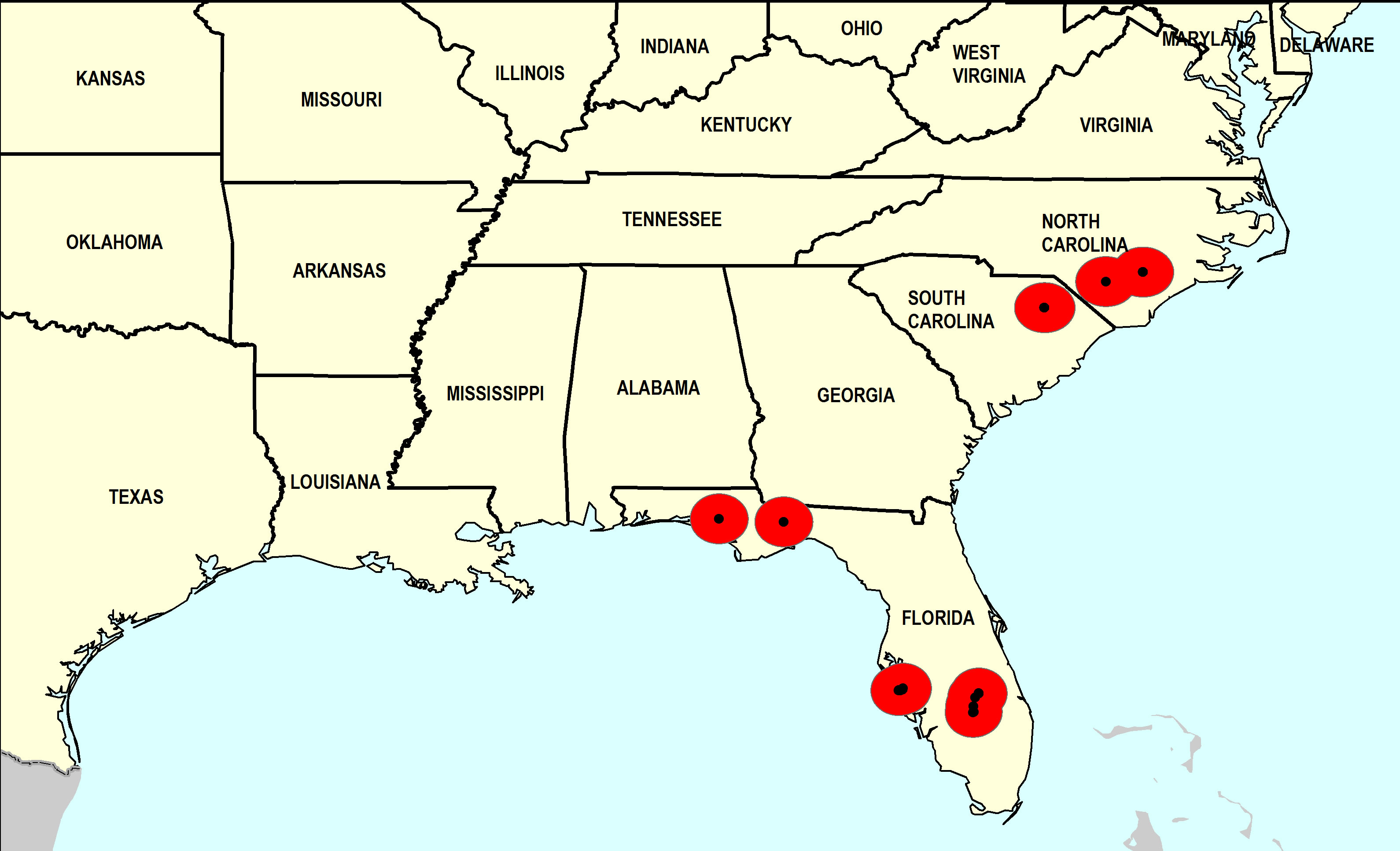
Paleogeographic Distribution
Southern Florida to North Carolina.
Remarks
For information on the modern distribution of the species, see Malacolog.
Synonymous with Timoclea grus and Tapes grus Holmes, 1858 (original combination).
Stratigraphic Occurrences
- Late Pleistocene
- Anastasia Formation (N. FL)
- Fort Thompson Formation (S. FL)
- Middle Pleistocene
- Bermont Formation (S. FL)
- Canepatch Formation (SC)
- Early Pleistocene
- Bear Bluff Formation (SC)
- Caloosahatchee Formation (S. FL)
- Nashua Formation (N. FL)
- Waccamaw Formation (SC, NC)
- Late Pliocene
- Duplin Formation (NC)
- Jackson Bluff Formation (N. FL)
- Raysor Formation (SC)
- Tamiami Formation (Pinecrest Beds) (S. FL)