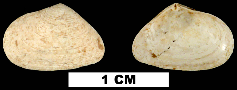
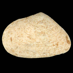
Cumingia tellinoides
- Phylum: Mollusca
- Class: Bivalvia
- Order: Imparidentia
- Family: Semelidae
- Genus: Cumingia
- Species: Cumingia tellinoides (Conrad, 1831)
- Common Name: Tellin semele
Geological Range
Late Pliocene to Late Pleistocene; Recent.
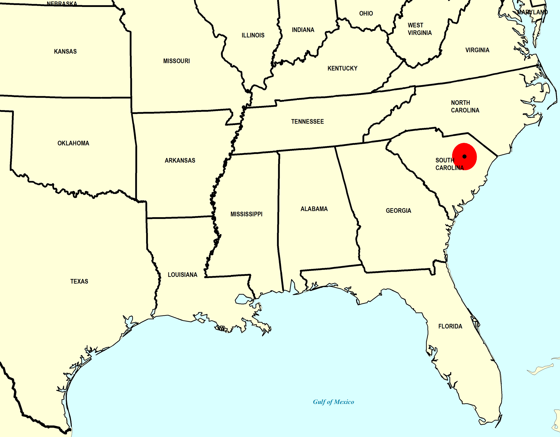
Paleogeographic Distribution
Southern Florida to North Carolina.
Remarks
For information on the modern distribution of the species, see Malacolog and WoRMS.
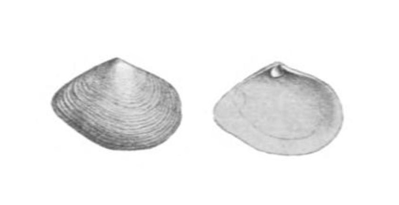
Original Description (from Conrad, 1838, p. 28-29):
"Shell ovate-trigonal, thin, with numerous prominent concentric wrinkled striae; anterior side ventricose; the posterior side contracted, subcuneiform; the base near the extremity slightly emarginate; cardinal fosset large; lateral teeth very prominent.
[...] Locality. James river, near Smithfield, Virginia.
Observations. I found a specimen of this shell between the laminae of the Chama corticosa, where it had evidently resided when living. Like the Saxicavae, and other lithophagous bivalves, it is irregular and variable in outline. In a recent state this species inhabits the coast of Rhode Island, and has been found as far south as Florida, but is very rare on the immediate coasts. I obtained a single valve on the beach of Sullivan's Island, near Charleston, South Carolina."
To access this description in its original formatting through Google Books, click here.
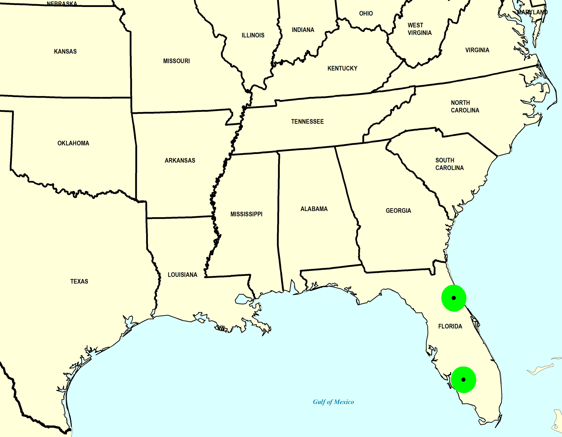
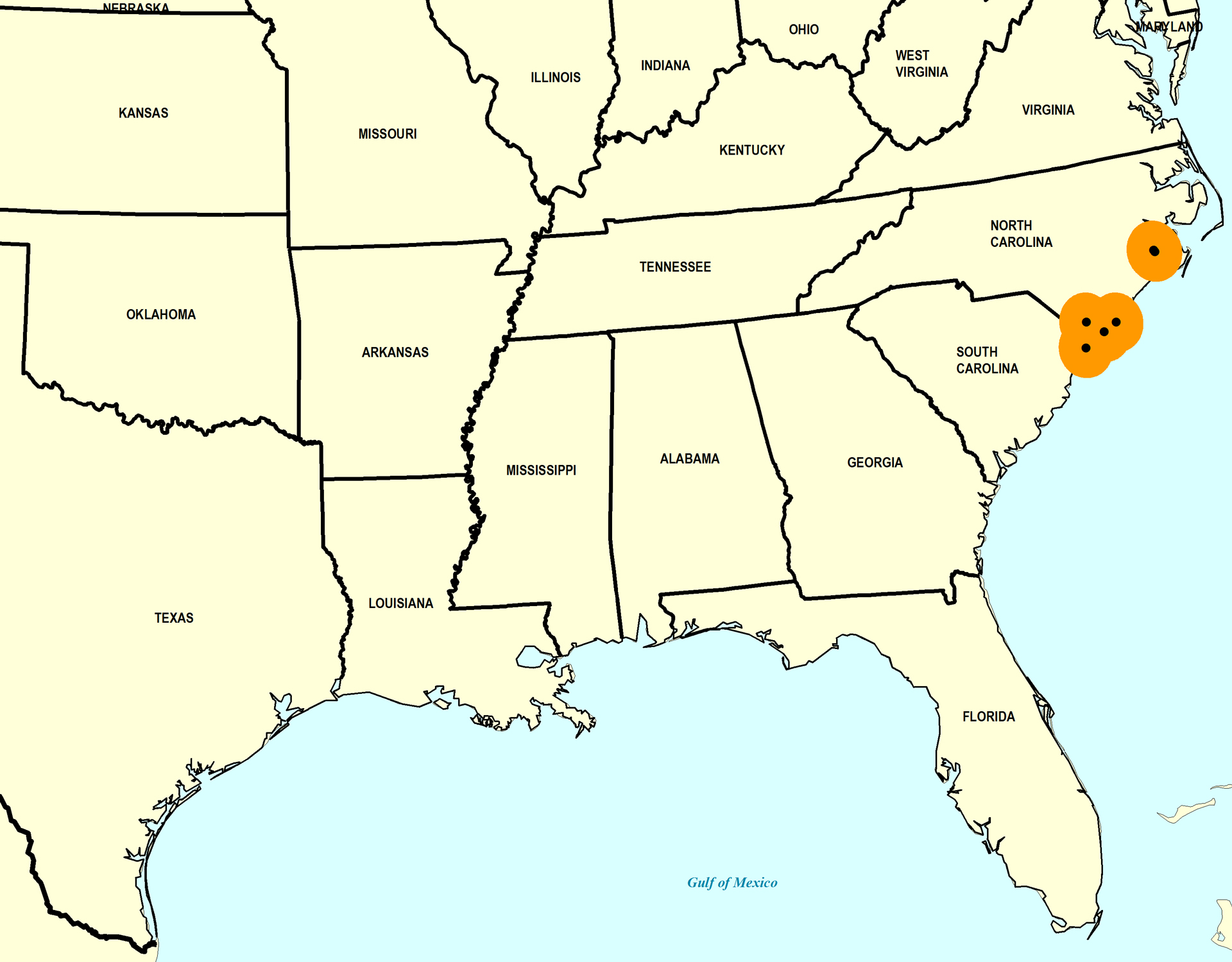
Stratigraphic Occurrences
- Late Pleistocene
- Fort Thompson Formation (S. FL)
- Pamlico Formation (N. FL)
- Middle Pleistocene
- Bermont Formation (S. FL)
- Canepatch Formation (SC)
- Early Pleistocene
- James City Formation (NC)
- Waccamaw Formation (SC, NC)
- Late Pliocene
- Duplin Formation (SC)