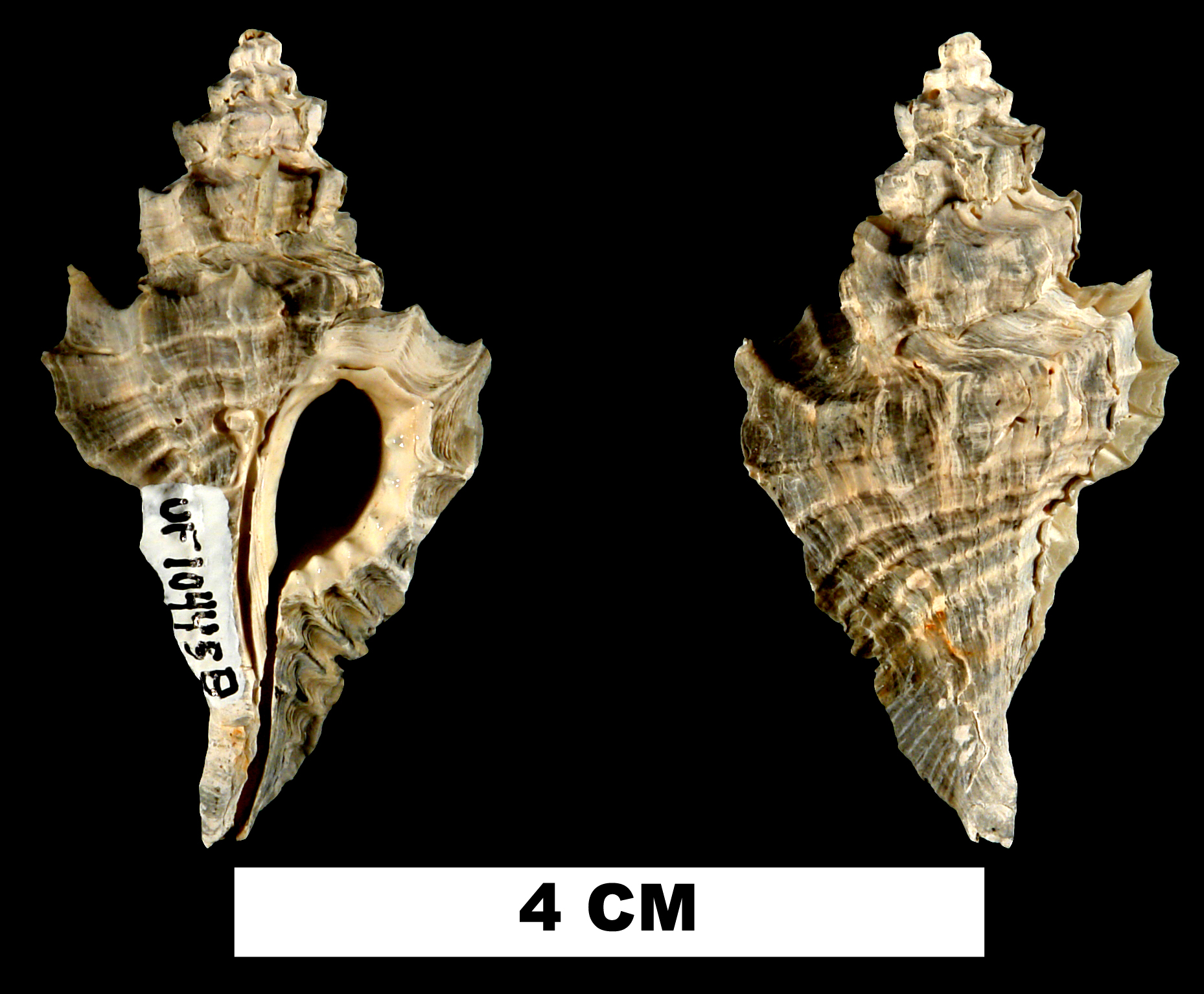
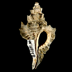
Eupleura leonensis
- Phylum: Mollusca
- Class: Gastropoda
- Order: Neogastropoda
- Family: Muricidae
- Genus: Eupleura
- Species: Eupleura leonensis (Mansfield, 1930)
Geological Range
Late Pliocene to Middle Pleistocene; Extinct.
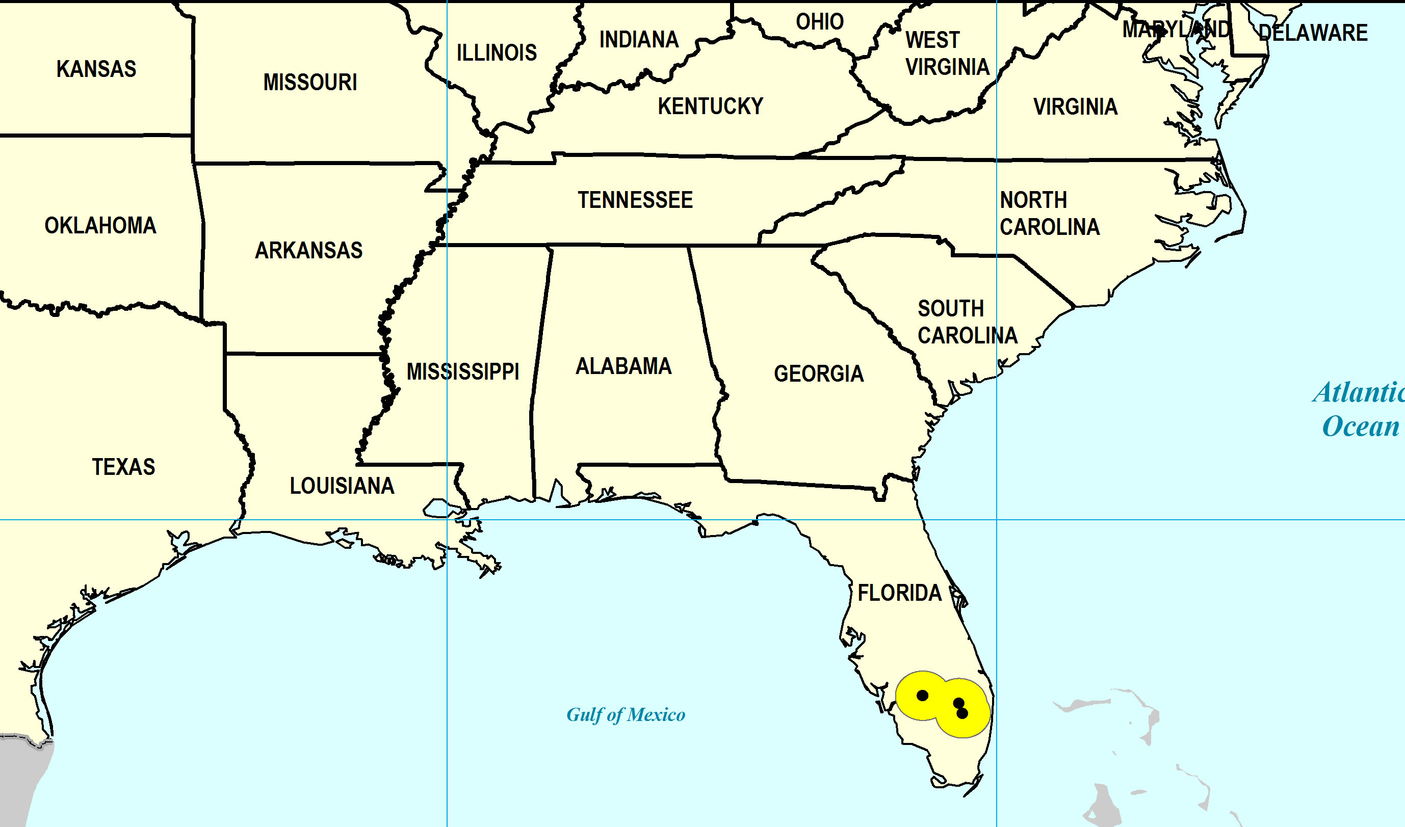
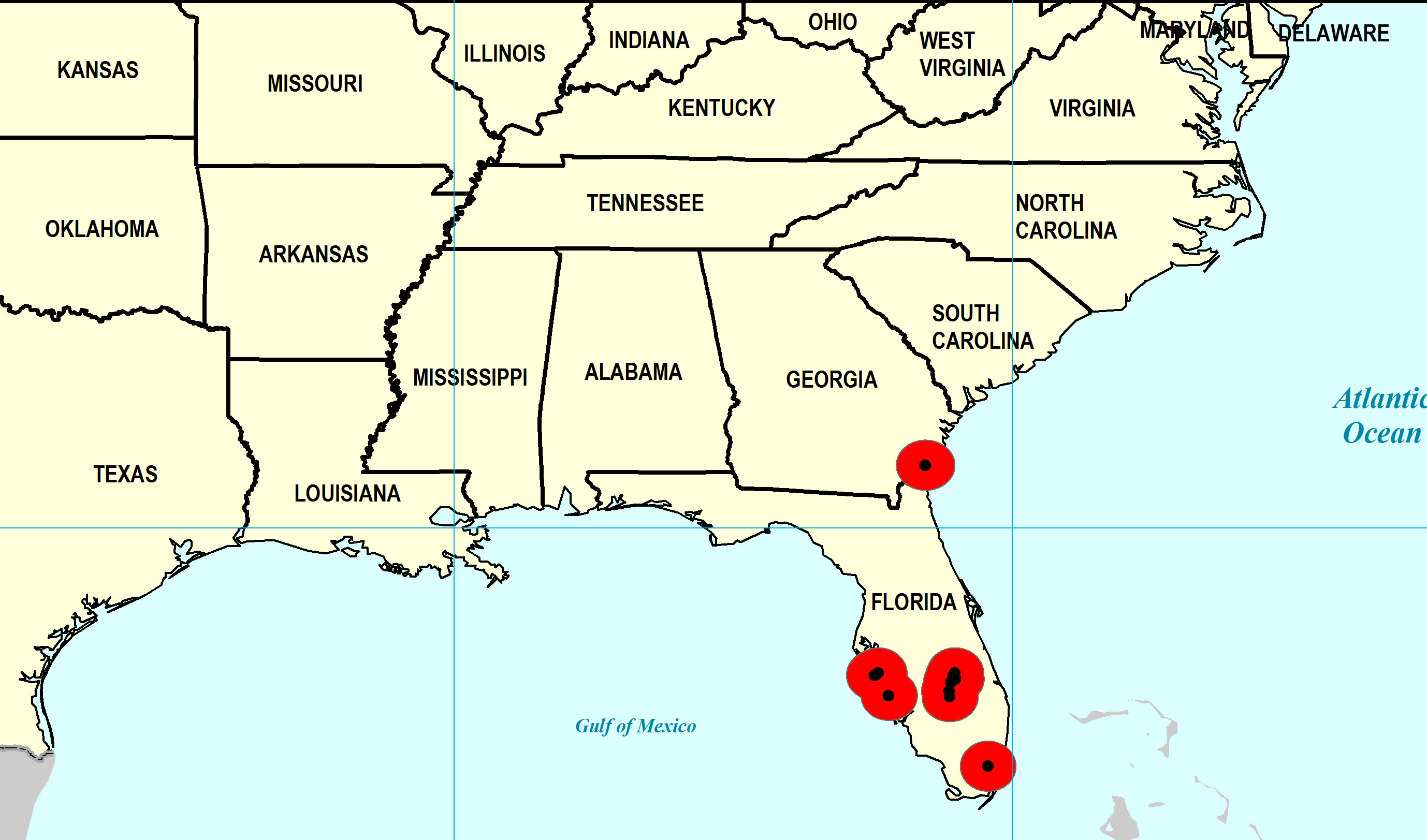
Paleogeographic Distribution
Southern Florida to North Carolina.
Remarks
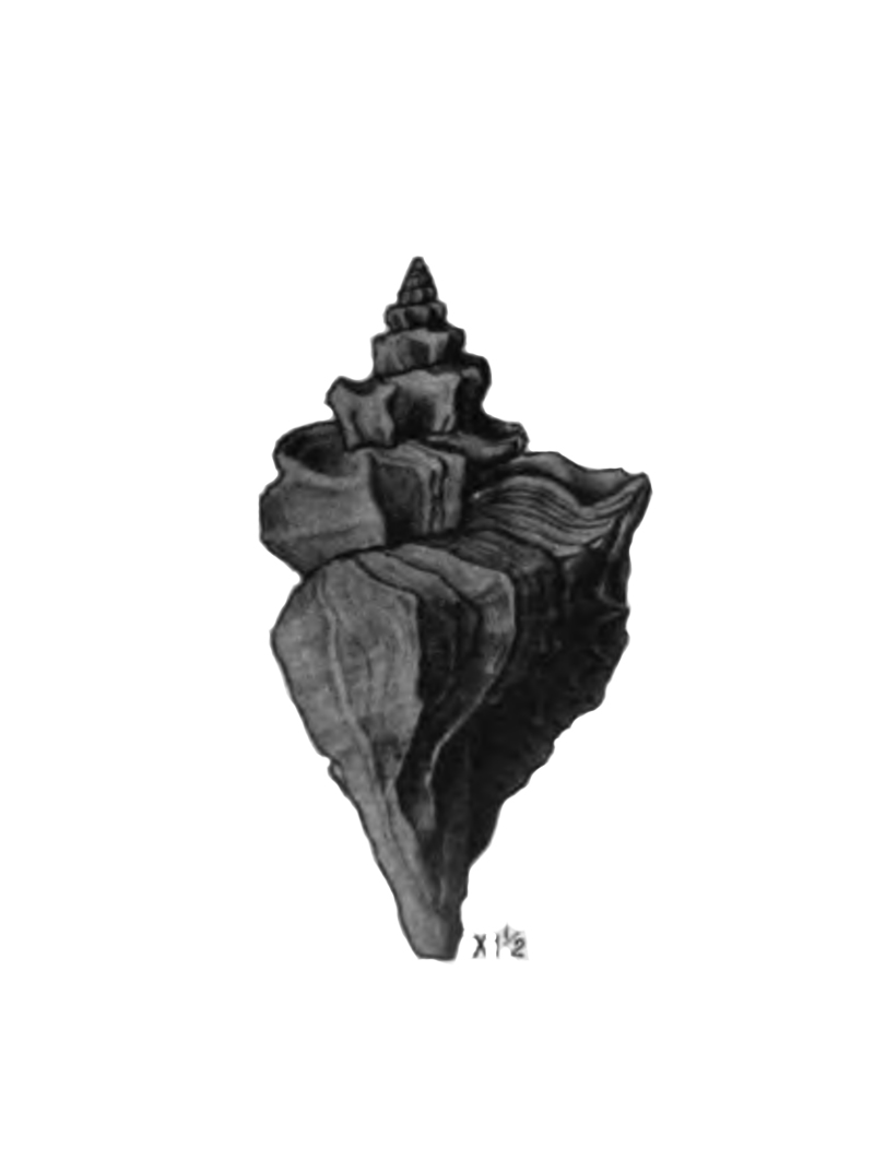
Original Description (from Mansfield, 1930, p. 86):
"Eupleura caudata leonensis closely resembles both Eupleura caudata sulcidentata Dall and E. caudata brevispira, new subspecies. It differs from the former in having more tabulated whorls and fewer and weaker spiral lines on the body whorl. E. caudata brevispira has a less acute spire. In other features the two Miocene subspecies closely agree.
The shell is rather large and consists of about seven whorls.
Type (U. S. N. M. Cat. No. 370197) measures: Altitude, 36 mm.; greatest diameter, 20 mm.
Occurrence: Upper Miocene: Harveys Creek, half a mile above abandoned mill, Leon County, Fla., type and only locality. The type was collected by the Florida State Geological Survey."
To access this description in its original formatting through Google Books, click here.
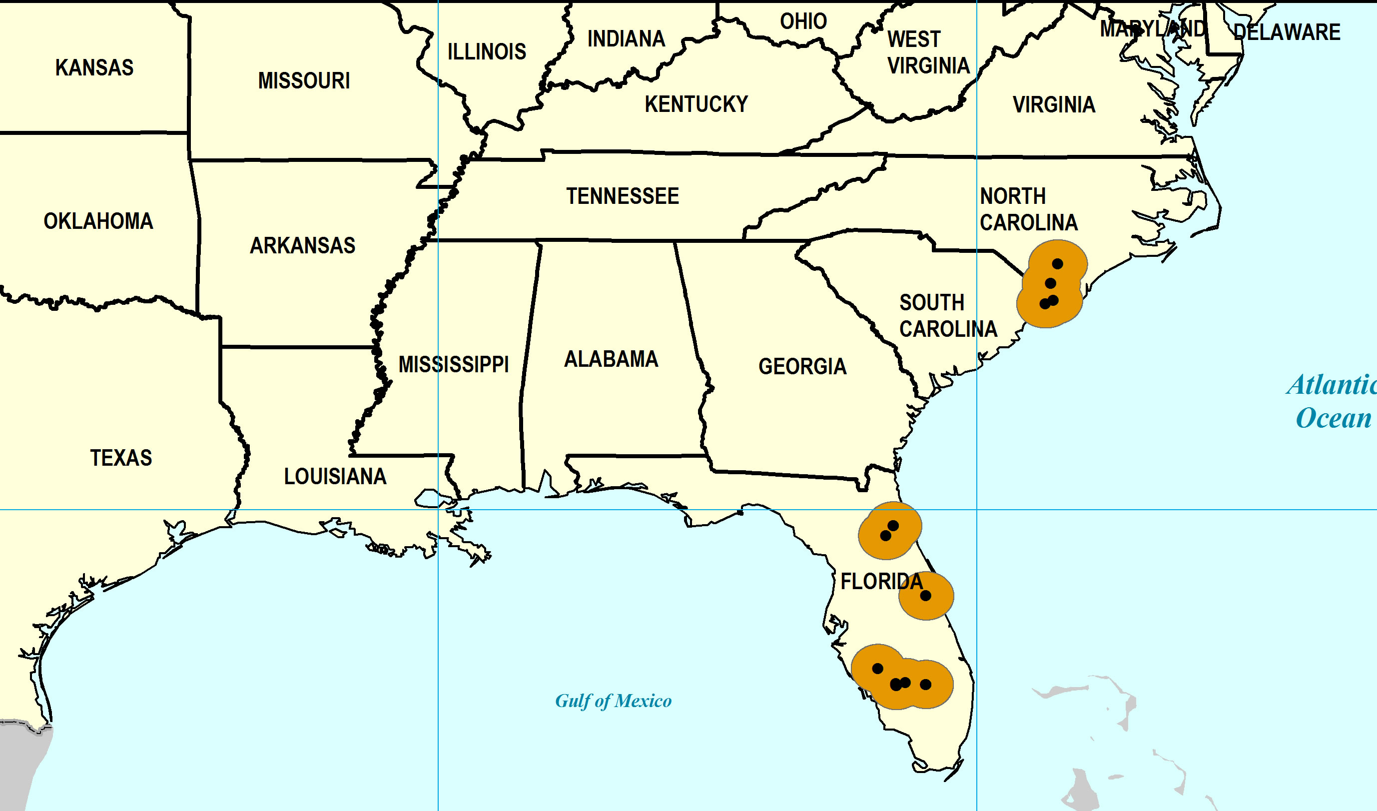
Stratigraphic Occurrences
- Middle Pleistocene
- Bermont Formation (S. FL)
- Early Pleistocene
- Caloosahatchee Formation (S. FL)
- Nashua Formation (N. FL)
- Waccamaw Formation (SC, NC)
- Late Pliocene
- Duplin / Raysor formations (GA)
- Tamiami Formation (Pinecrest Beds) (S. FL)