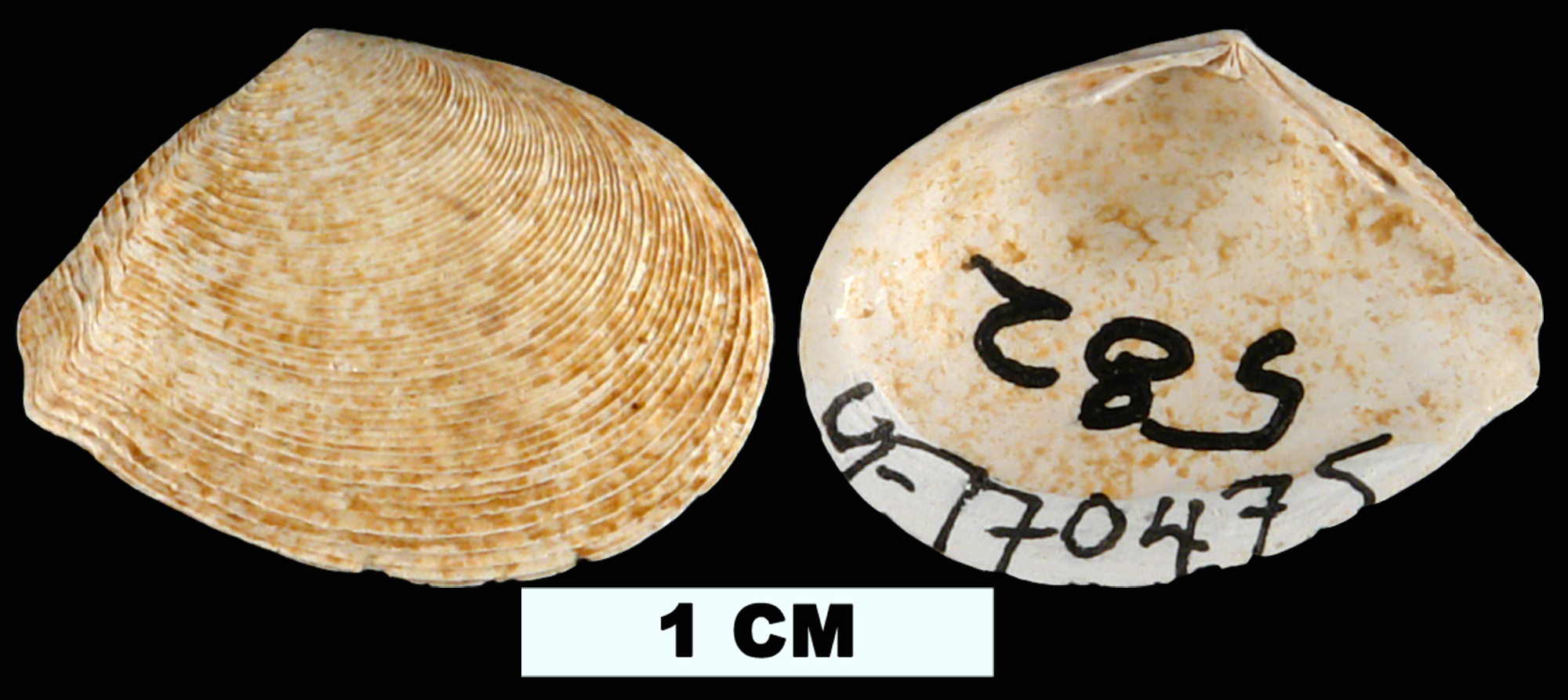
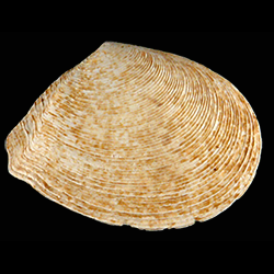
Merisca aequistriata
- Phylum: Mollusca
- Class: Bivalvia
- Order: Imparidentia
- Family: Tellinidae
- Genus: Merisca
- Species: Merisca aequistriata (Say, 1824)
- Common Name: Striate tellin
Geological Range
Middle-Late Miocene to Late Pleistocene; Recent.
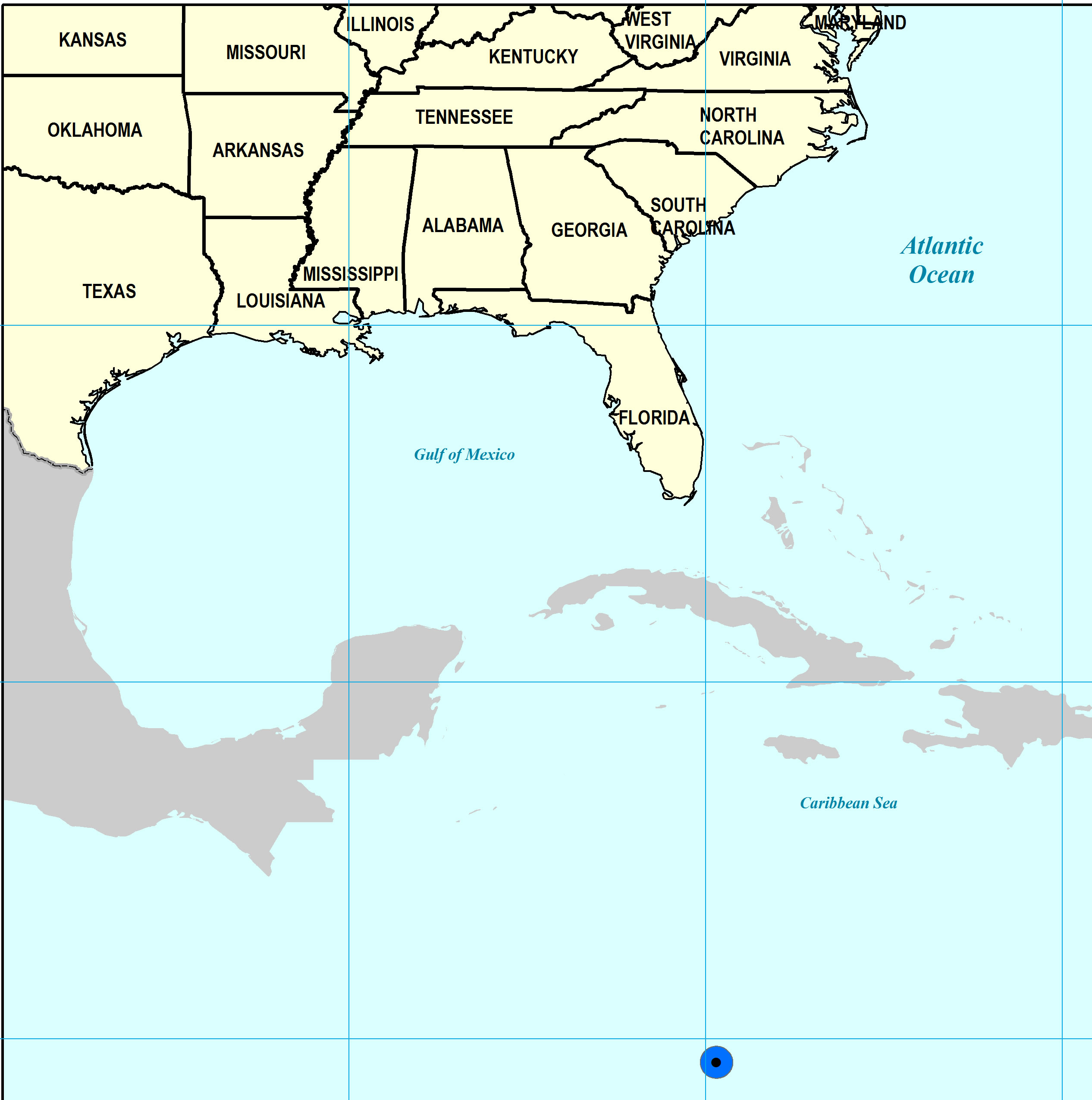
Paleogeographic Distribution
Cayman Islands to Georgia.
Remarks
For information on the modern distribution of the species, see Malacolog.
Original Description (from Say, 1824, p. 145):
"Shell transversely ovate-orbicular, with an elevated line or fold on the anterior margin: surface with fine, somewhat elevated, concentric, nearly equal, numerous striae, forming grooves between them: apex nearly central, acute: cardinal teeth deeply grooved: lateral teeth two; edge within, simple.
Length seven-tenths, breadth nineteen-twentieths of an inch.
In general outline, this species has a resemblance to T. ostracea, Lam. In one specimen the apex is central, and in another it is placed before the middle."
To access this description in its original formatting through the Biodiversity Heritage Library, click here.
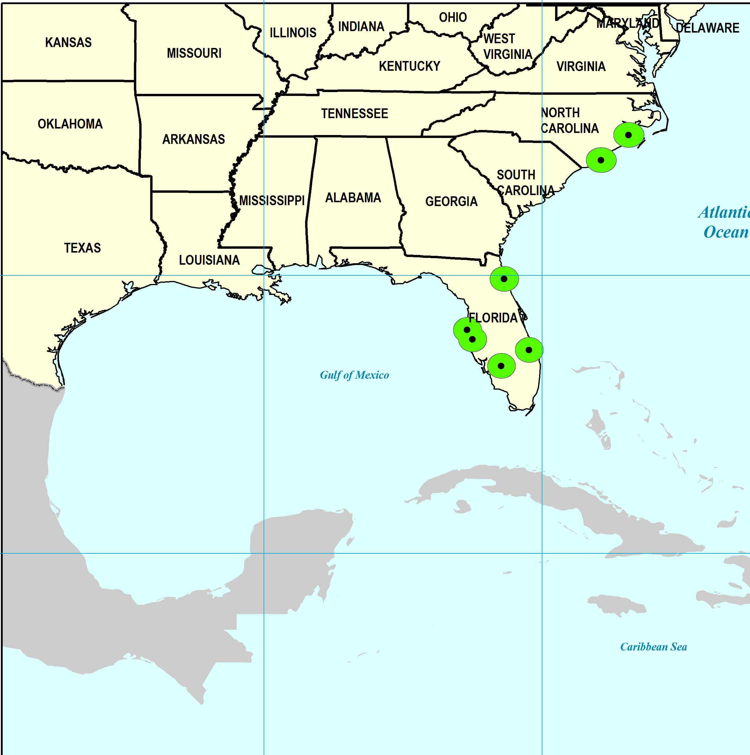
Stratigraphic Occurrences
- Late Pleistocene
- Anastasia Formation (N. FL)
- Fort Thompson Formation (S. FL)
- Neuse Formation (NC)
- Pamlico Formation (S. FL)
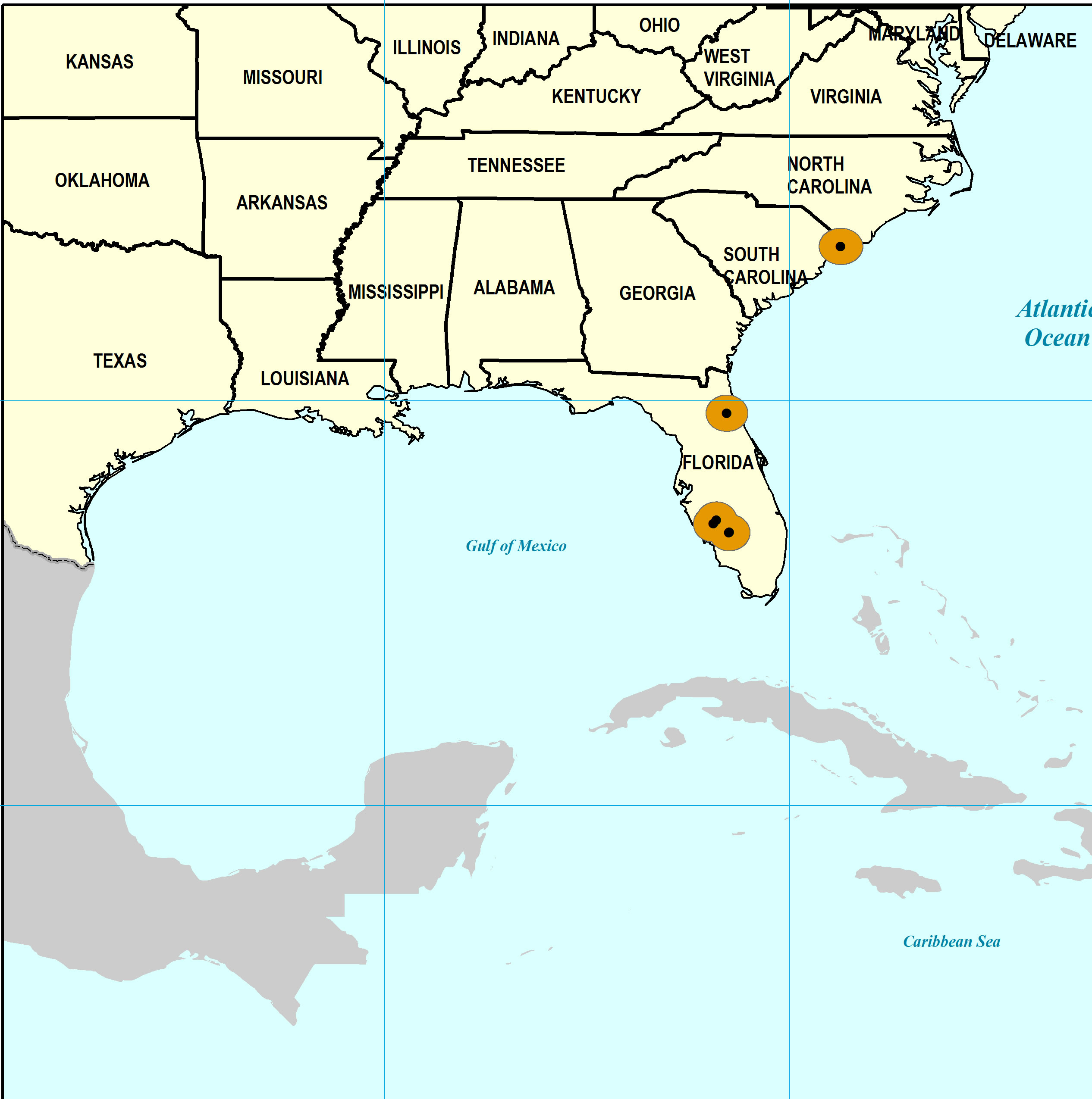
- Middle Pleistocene
- Bermont Formation (S. FL)
- Early Pleistocene
- Caloosahatchee Formation (S. FL)
- Nashua Formation (N. FL)
- Waccamaw Formation (SC)
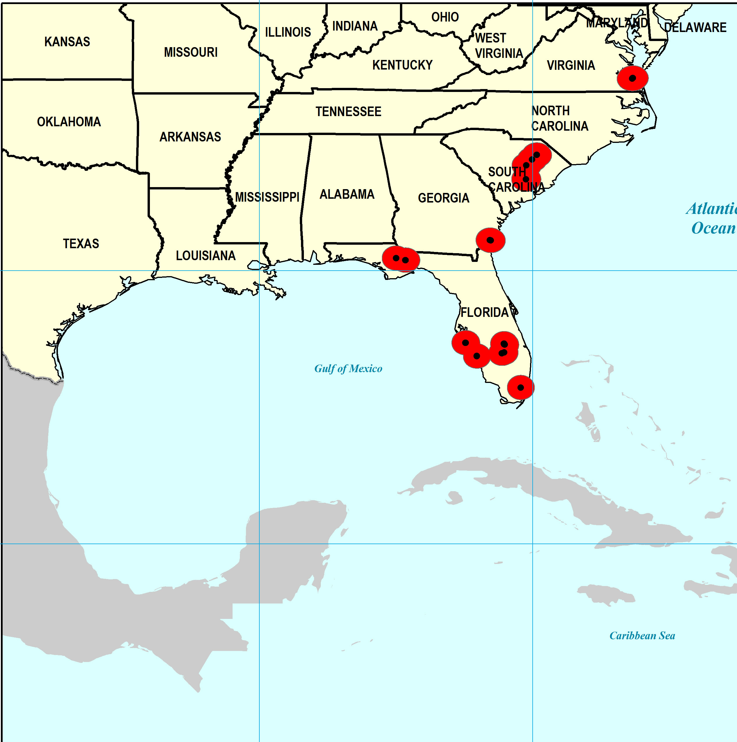
- Late Pliocene
- Duplin Formation (SC)
- Duplin / Raysor formations (GA)
- Jackson Bluff Formation (N. FL)
- Raysor Formation (SC)
- Tamiami Formation (Pinecrest Beds) (S. FL)
- Yorktown Formation (VA)
- Middle Miocene
- Gatun Formation (Panama)
- Early Miocene
- Chattahoochee Formation (N. FL)