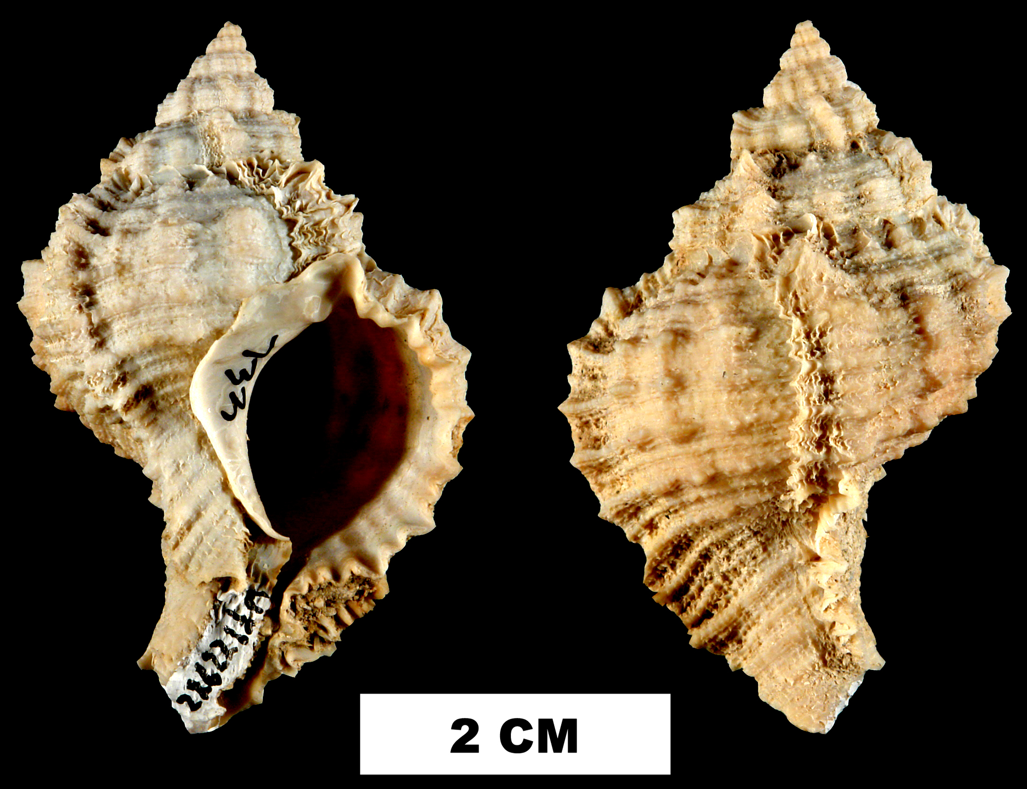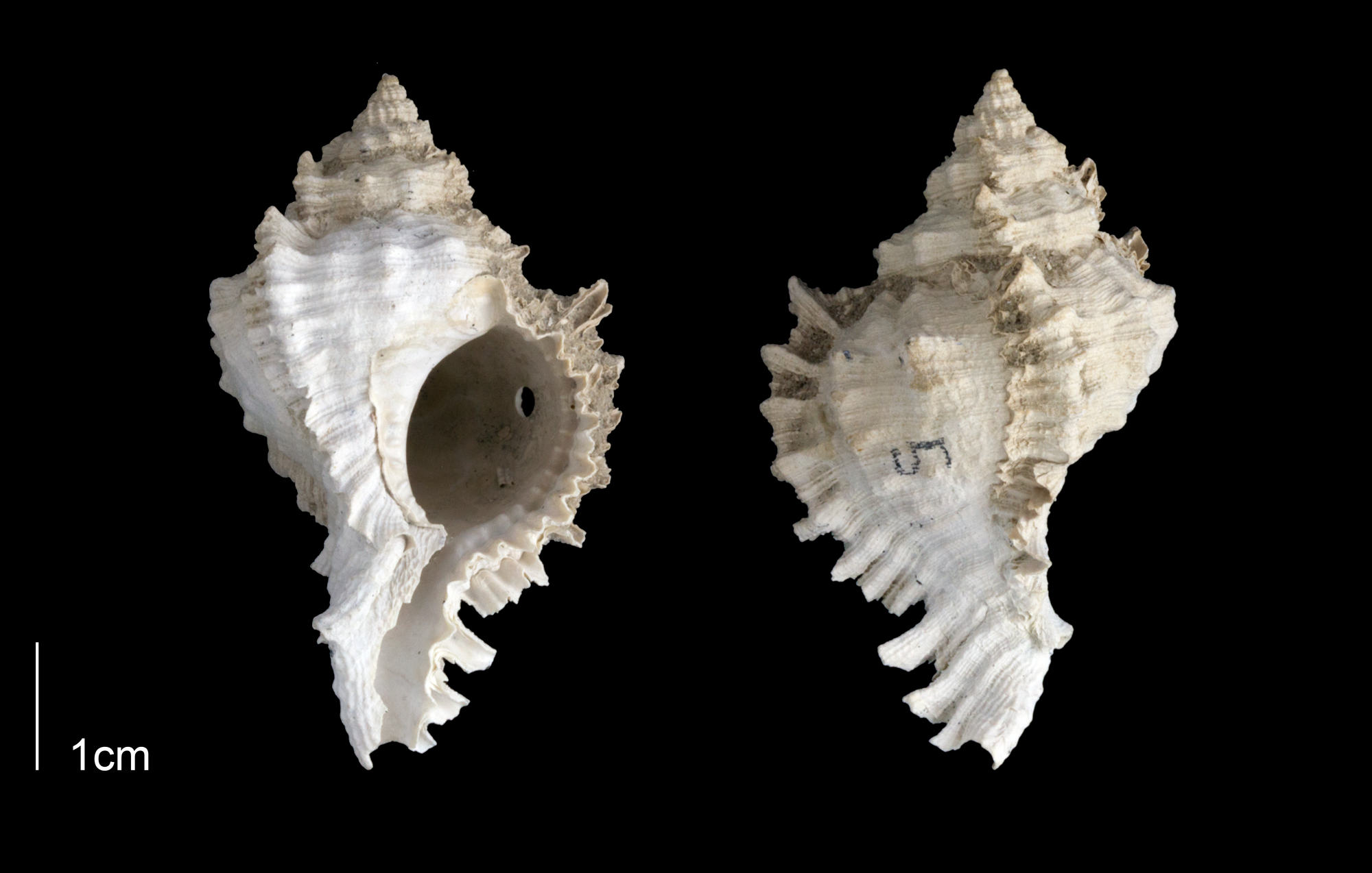
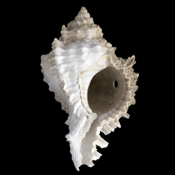
Phyllonotus globosus
- Phylum: Mollusca
- Class: Gastropoda
- Order: Neogastropoda
- Family: Muricidae
- Genus: Phyllonotus
- Species: Phyllonotus globosus (Emmons, 1858)
- Common Name: Globular apple murex
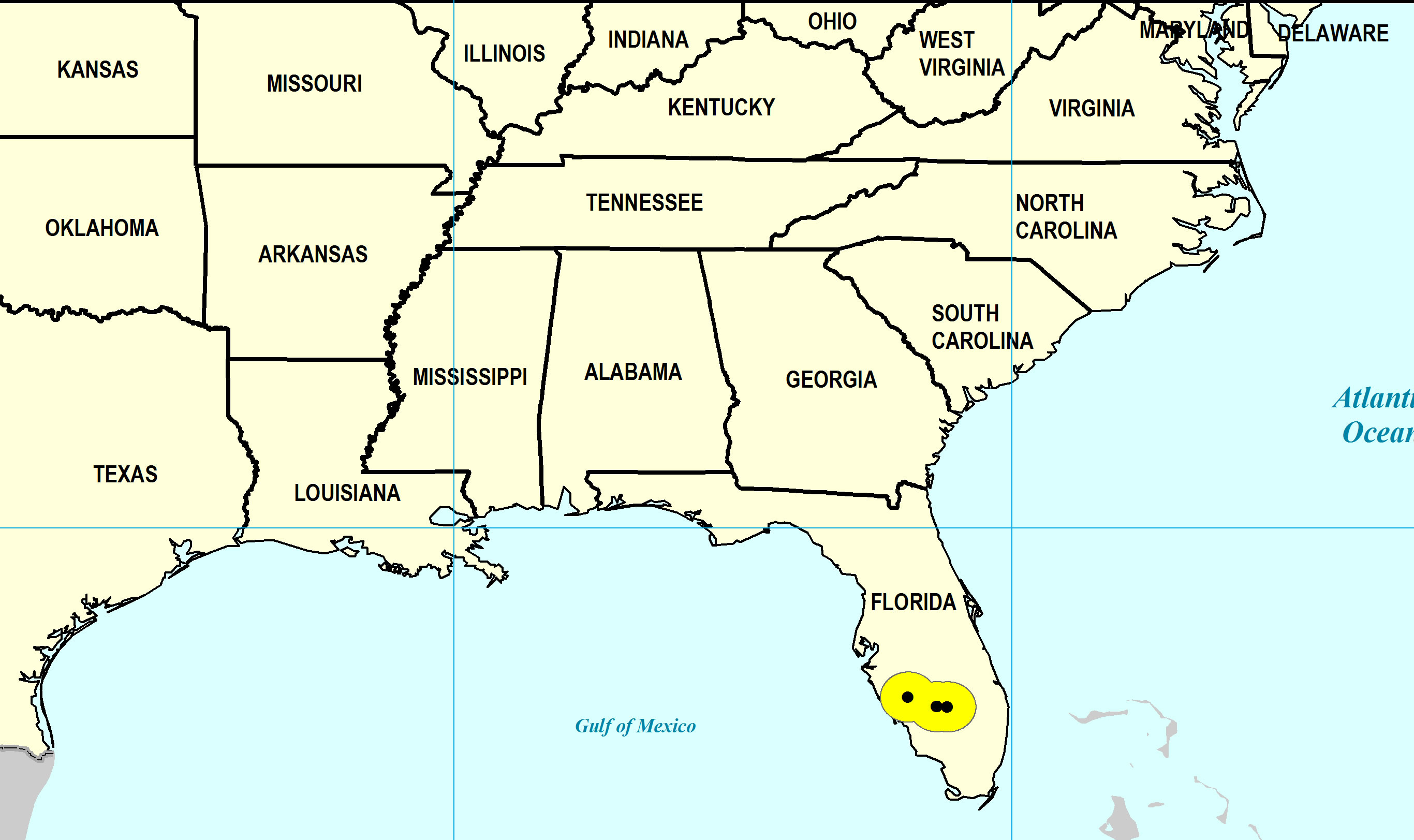
Geological Range
Late Pliocene to Middle Pleistocene; Recent.
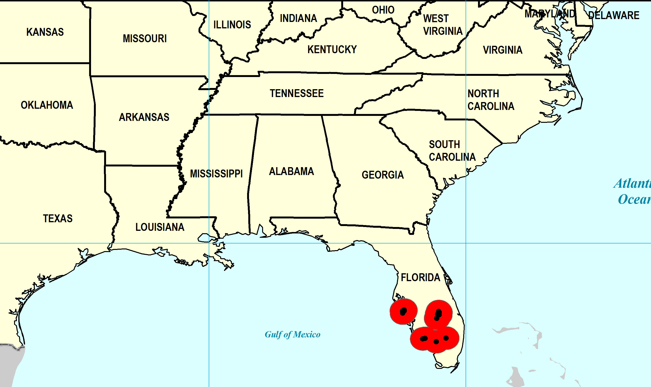
Paleogeographic Distribution
Southern Florida to South Carolina.
Remarks
For information on the modern distribution of the species, see Malacolog.
Original Description (from Emmons, 1858, p. 247-248):
"Shell rather globose, or obtusely fusiform, and with four principal varices; intermediate ones ireegular and spirally, traversed by many angular ridges, body whirl inflated, aperture oval, peristome continuous, and extended posteriorly on the body whirl, forming an angulated canal; outer lip ridged within and crenulated on the margin; collumella lip ridged, and one ridge at the posterior angle; beak reflexed. Miocene of the Cape Fear River; half the natural size."
To access this description in its original formatting through the Biodiversity Heritage Library, click here.
Synonymous with Murex globosus Emmons, 1858 (original combination) and Chicoreus globosus.
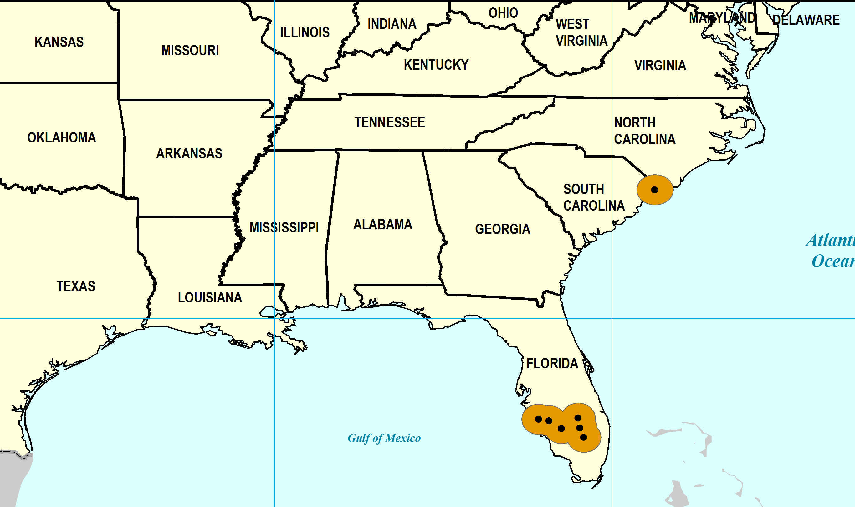
Stratigraphic Occurrences
- Middle Pleistocene
- Bermont Formation (S. FL)
- Early Pleistocene
- Caloosahatchee Formation (S. FL)
- Waccamaw Formation (SC)
- Late Pliocene
- Tamiami Formation (Pinecrest Beds) (S. FL)