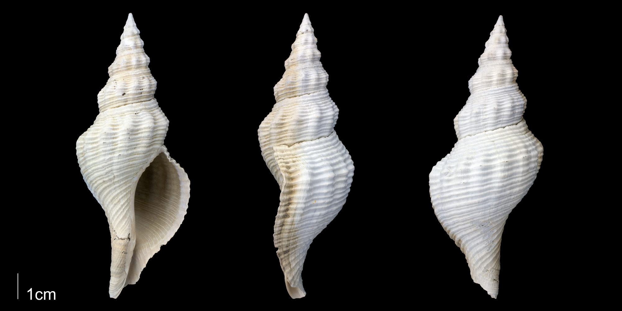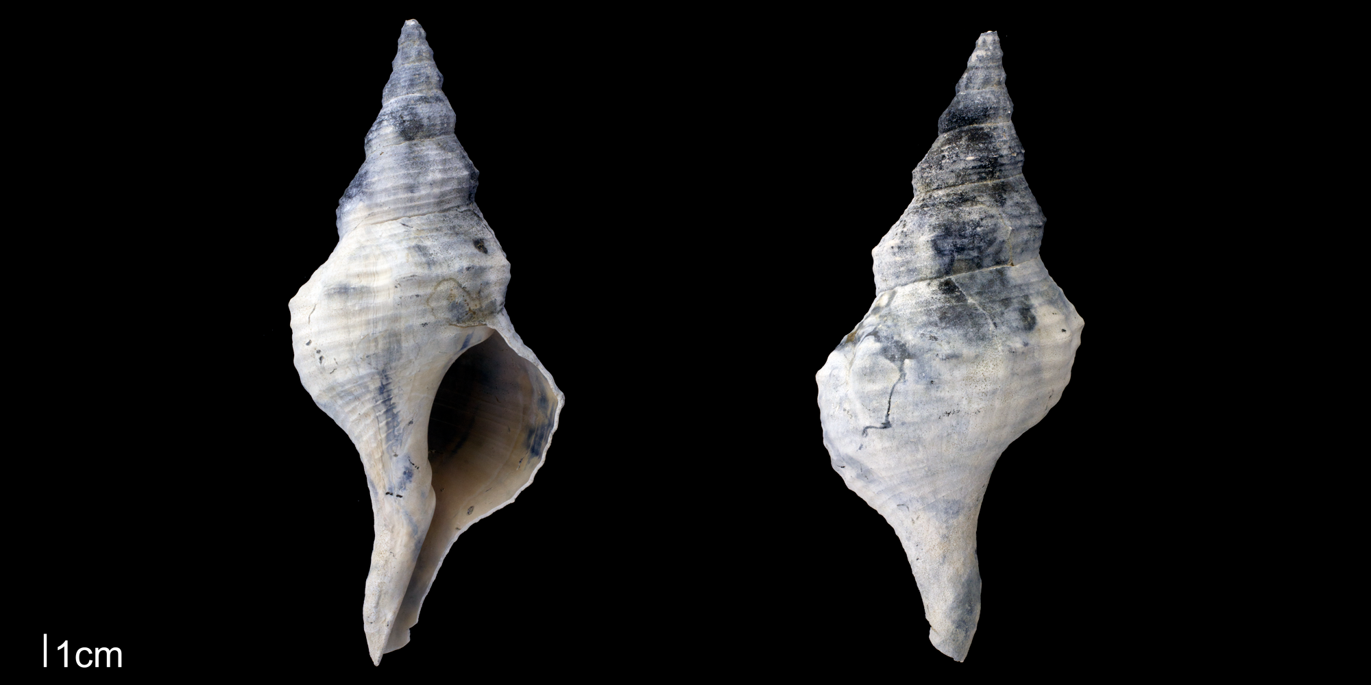
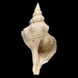
Triplofusus giganteus
- Phylum: Mollusca
- Class: Gastropoda
- Order: Neogastropoda
- Family: Fasciolariidae
- Genus: Triplofusus
- Species: Triplofusus giganteus (Kiener, 1840)
- Common Name: Florida horse conch
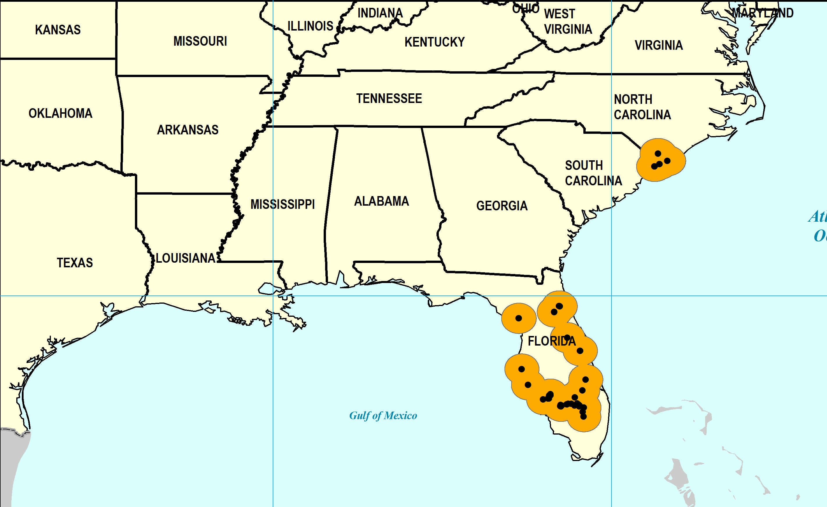
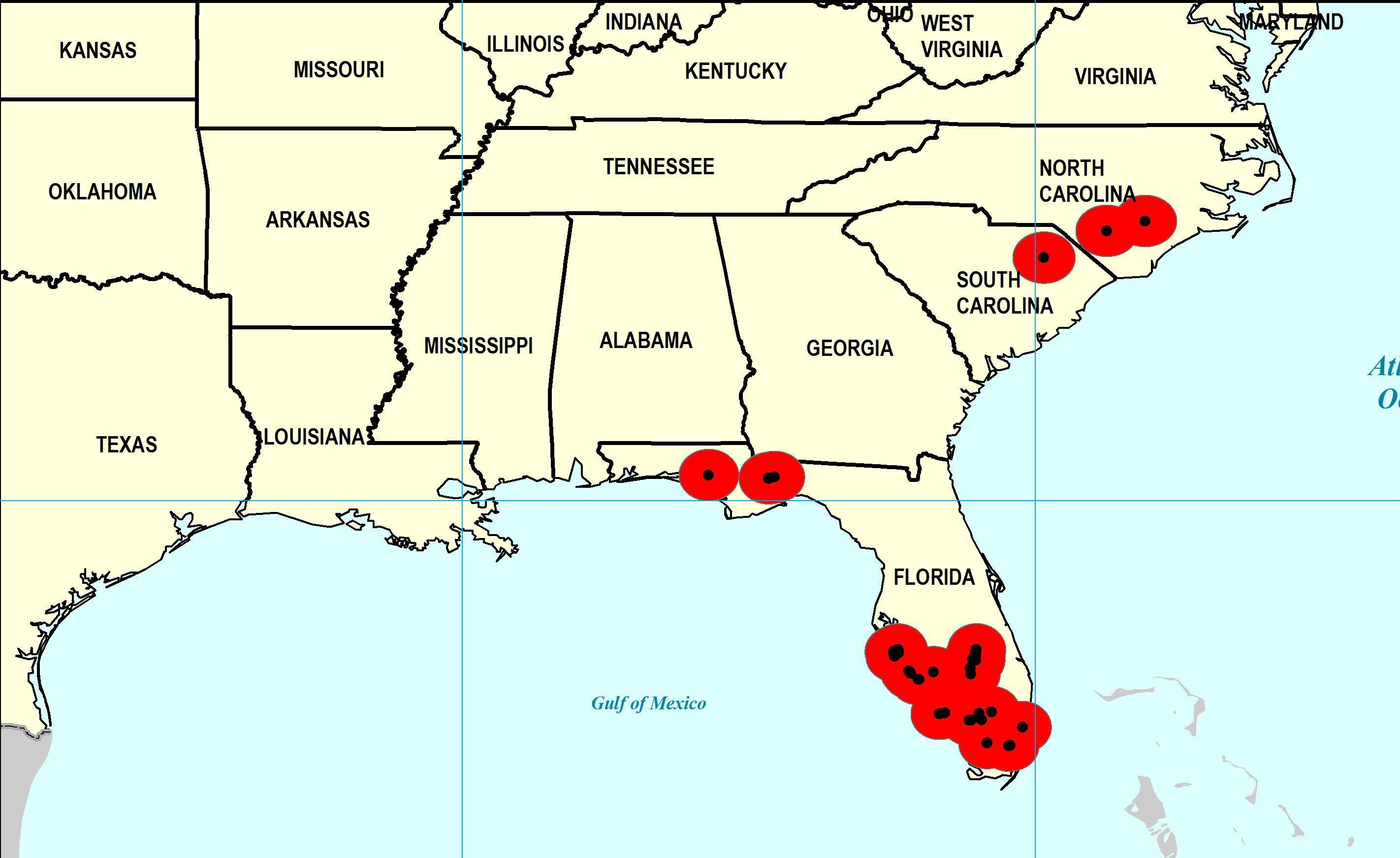
Geological Range
Late Pliocene to Late Pleistocene; Recent.
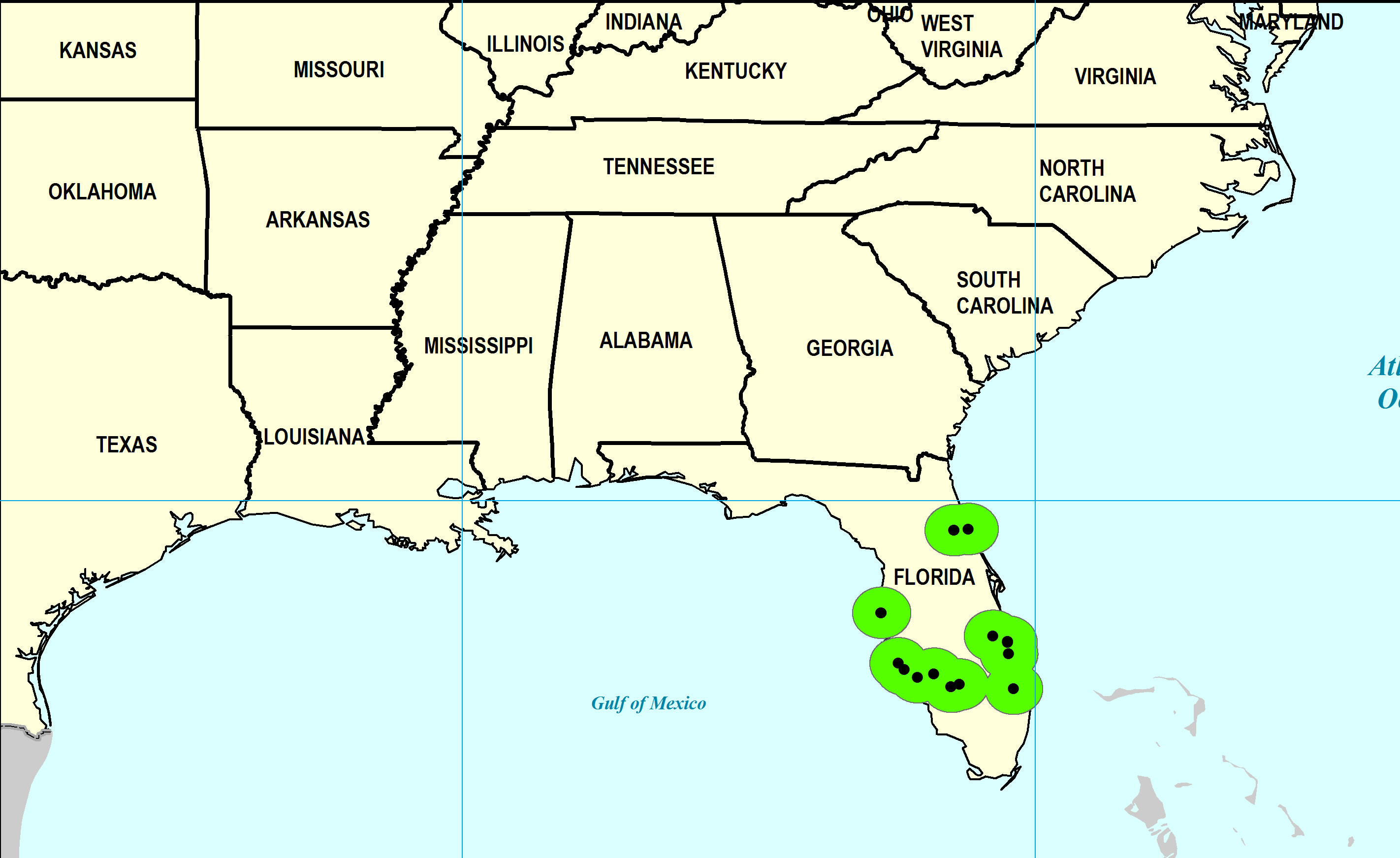
Paleogeographic Distribution
Southern Florida to North Carolina.
Remarks
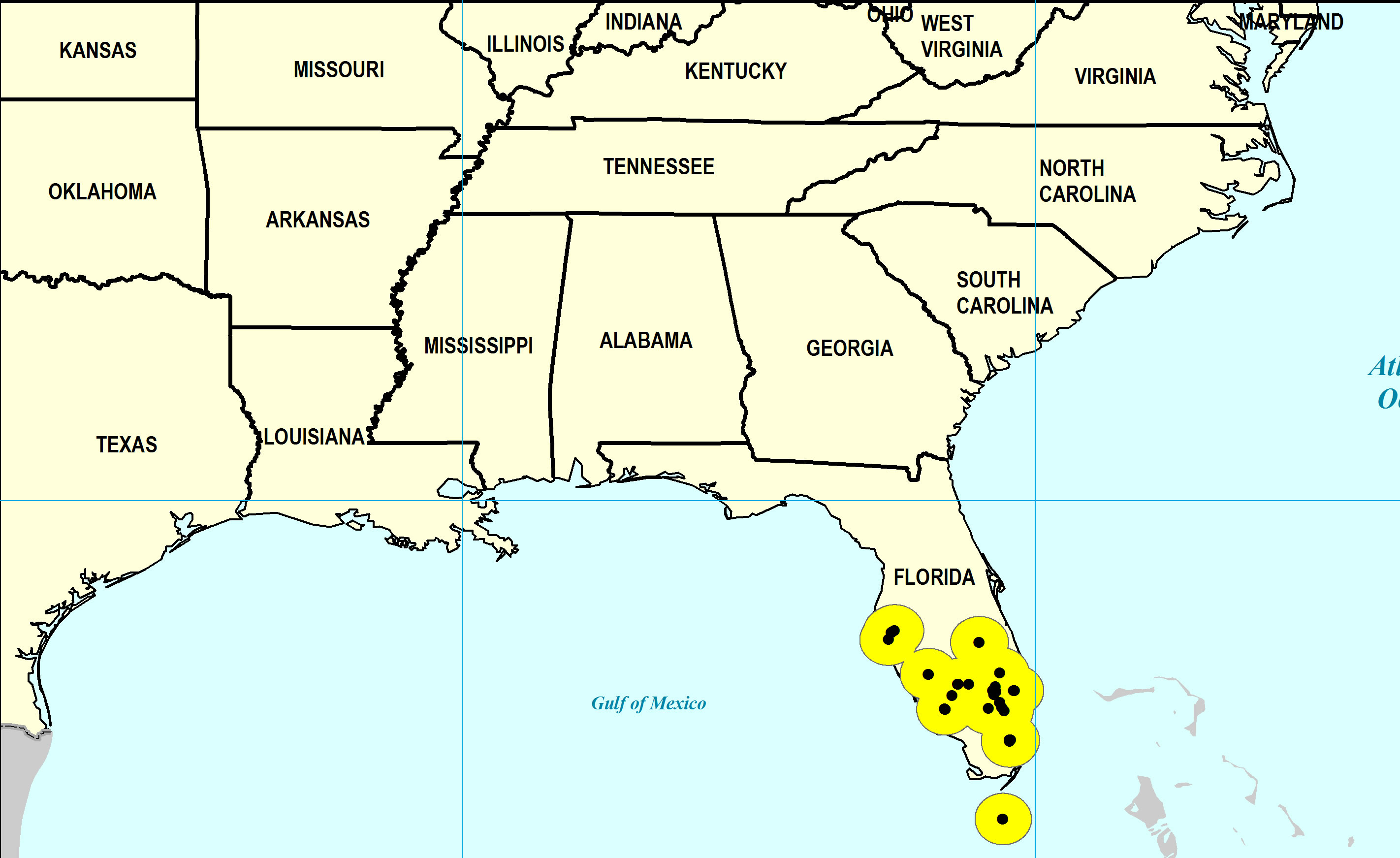
For information on the modern distribution of the species, see Malacolog.
Stratigraphic Occurrences
- Late Pleistocene
- Anastasia Formation (S. FL, N. FL)
- Coffee Mill Hammock Formation (S. FL)
- Fort Thompson Formation (S. FL)
- Pamlico Formation (S. FL, N. FL)
- Middle Pleistocene
- Bermont Formation (S. FL)
- Early Pleistocene
- Caloosahatchee Formation (S. FL)
- Nashua Formation (N. FL)
- Waccamaw Formation (SC, NC)
- Late Pliocene
- Duplin Formation (NC)
- Jackson Bluff Formation (N. FL)
- Raysor Formation (SC)
- Tamiami Formation (Murdock Station Member) (S. FL)
- Tamiami Formation (Ochopee Limestone) (S. FL)
- Tamiami Formation (Pinecrest Beds) (S. FL)